

Abhishek
Writer
Updated On - Aug 19, 2026
25 min
Published On - Jul 11, 2026
Himachal Pradesh — The Complete Northern Circuit Road Trip
From the Queen of Hills to the last village before Tibet. Across the world's most dangerous safe road and through the oldest monastery in the Himalayas. Down from the cold desert plateau to the world's second-highest paragliding site and on to the hill station where a Tibetan exile has been running for sixty-five years. Fourteen to seventeen days. Roughly two thousand kilometres. One road trip that contains everything India's most extraordinary mountain state has to offer.
The checkpoint at Sumdo is not a dramatic place. There is a barrier, a small office, a flag, and a mountain view that extends to a horizon so high it takes a moment to calibrate. This is where the Himachal Pradesh road on the Kinnaur side crosses into Spiti Valley — not the district boundary, which comes earlier, but the specific checkpoint that most travellers remember as the moment the journey changed character. Behind you, for the last three days, has been the Kinnaur gorge, the Hindustan-Tibet Highway carved into cliff faces above the Sutlej, the apple orchards of Sangla and the Baspa Valley, the 12th-century fort at Kamru, the road's-end at Chitkul where a sign says something in Hindi about not going further. Ahead is Tabo, with its thousand-year-old frescoes. And beyond that, Kaza, and the high monastery circuit of Spiti, and the crescent lake at Chandratal, and the boulder-strewn crossing of Kunzum Pass at 4,551 metres that will, in its own way, mark the other end of this particular kind of travelling.
The Himachal Pradesh northern circuit is, by any objective measure, one of the great road journeys of the world. It is not the most dramatic in terms of raw altitude — Ladakh takes that — and it is not the most polished in terms of infrastructure. What it is, is comprehensive: a single connected loop that passes through more distinct geographic and cultural zones than most travellers encounter in a lifetime of holidays. Colonial Shimla. The Buddhist kingdom remnants of Kinnaur. Spiti's cold desert monasteries. The adventure corridor of Manali and Solang. The wine-and-orchard country of Kullu. Bir Billing, the world's second-highest paragliding site. The Tibetan exile community of McLeod Ganj. The Victorian hill station of Dalhousie with its meadow that a Swiss diplomat declared looked more like his homeland than anywhere else on the subcontinent. All of these places, on a single road, in a single journey, in two weeks.
This guide is built for the driver, the navigator, and the planner. It contains the honest road condition report for every segment as of 2026, all the regulatory changes that came into effect this year, the fuel stops that actually matter, the altitude acclimatisation logic that prevents a ruined trip, and the itinerary sequence that experienced Himachal travellers consistently recommend. The direction is important: enter via Shimla, exit via Manali. This is the medically and logistically superior approach, and the first section of this guide will explain exactly why.
The Logic of the Northern Circuit...
The most common mistake in planning the Himachal northern circuit is the direction. Many first-time visitors, looking at a map and noting that Manali is the most famous entry point, propose driving from Delhi to Manali and then east into Spiti via Kunzum Pass. This plan has an altitude problem. Manali sits at 2,050 metres. Kunzum Pass, which you cross on the Manali-to-Spiti route, sits at 4,551 metres. In a single day's drive, you gain over 2,500 metres of altitude — and you do so before your body has had any time to adjust to the mountain air. The result, for a significant proportion of travellers who attempt this direction, is acute mountain sickness: headache, nausea, and a completely ruined first day in Spiti, which is a valley that deserves better.
The Shimla route does the opposite. It enters via NH-5, the old Hindustan-Tibet Highway, which follows the Sutlej River gorge through Kinnaur at a gradual altitude gain — you spend Day 2 at Sarahan (2,165m), Day 4 at Kalpa (2,960m), Day 5 at Nako (3,625m), and Day 6 at Tabo (3,280m), before arriving at Kaza (3,800m) on Day 7. By the time you reach Kaza, your body has been adjusting to increasing altitude for six days. The Kunzum crossing, which comes on Day 10 of the circuit, is approached from Kaza (3,800m) rather than from Manali (2,050m); the altitude gain is from 3,800m to 4,551m in a single drive — manageable rather than reckless. Enter via Shimla. Exit via Manali. This is the correct direction.
The circuit is best described in five chapters. Chapter One is the colonial and orchard corridor: Chandigarh to Shimla to the Kinnaur gorge, a journey through India's British-era mountain infrastructure and its richest apple country. Chapter Two is the ancient highway: Kinnaur's half-tunnels and cliff roads, Sangla and Chitkul, Kalpa and Reckong Peo, the approach to Nako and Tabo through the deepening trans-Himalayan landscape. Chapter Three is the Spiti plateau: Tabo, Dhankar, Kaza, the monastery circuit of Ki and Komic and Kibber, Chandratal Lake at 4,300 metres under a sky with twice as many visible stars as anywhere with light pollution. Chapter Four is the crossing and descent: Kunzum Pass at 4,551 metres, the boulder track from Batal to Gramphu, the Atal Tunnel, Manali. Chapter Five is the Kangra Valley and the Chamba hills: Bir Billing's thermal currents, McLeod Ganj's prayer flags, Dalhousie's deodar forest, Khajjiar meadow, and the road home through Pathankot and the plains.
Each chapter has a different register — a different quality of road, a different kind of landscape, a different relationship between the traveller and the mountain. Experienced drivers who have done the circuit multiple times consistently say that the whole is greater than the sum of its individual parts, and that the accumulation of five chapters over two weeks produces a sense of the subcontinent's mountain geography that no single destination — not Shimla alone, not Spiti alone, not Manali alone — can replicate.
| FACT | DETAIL |
|---|---|
|
Circuit name |
Himachal Pradesh Northern Circuit — The Grand Loop |
|
Total distance |
~2,000–2,200 km (Chandigarh base, full circuit) |
|
Ideal duration |
14–16 days minimum; 18–21 days for comfort |
|
Circuit direction |
Chandigarh → Shimla → Kinnaur → Spiti → Manali → Kullu/Kangra → back |
|
Entry/exit point |
Chandigarh (most practical); Delhi (alternative via Ambala) |
|
Best overall season |
Mid-June to mid-October (full circuit including Kunzum Pass) |
|
Kinnaur-only season |
Year-round (Shimla side); recommended May–October |
|
Kunzum Pass opening |
Usually late May–early June; confirmed open June 2026 |
|
Kunzum Pass altitude |
4,551 m (14,931 ft) |
|
Rohtang Pass altitude |
3,978 m (13,051 ft); permit ₹550; closed Tuesdays |
|
Highest point on circuit |
Chandratal Lake / Kunzum Pass area (~4,551 m) |
|
HP vehicle entry toll 2026 |
₹100/day (private cars registered outside HP) — from April 1, 2026 |
|
e-Aagman registration |
Mandatory for all vehicles entering Lahaul-Spiti district |
|
Rohtang permit |
₹550 (₹500 + ₹50); book hp.gov.in; quota 1,200/day; closed Tuesdays |
|
PAP (foreign nationals) |
Required for Kinnaur restricted zones (past Jangi) and full Spiti; SDM Reckong Peo |
|
Plastic ban |
Single-use plastic strictly banned across Himachal Pradesh (2026 enforcement) |
|
Key fuel stops |
Chandigarh; Shimla; Rampur; Tapri (last before Peo); Reckong Peo; Kaza; Manali; Kullu |
|
Last ATM before Spiti |
Reckong Peo (Kinnaur side); Kaza (for Spiti); fill cash before entering |
|
Vehicle recommendation |
High-clearance SUV/4WD essential for Batal–Gramphu section; sedan manageable Shimla–Kaza |
CIRCUIT AT A GLANCE — KEY FACTS 2026
THE HIMACHAL NORTHERN CIRCUIT IS LIKE THE MOST ELABORATE TASTING MENU IN THE WORLD — A DOZEN DISTINCT COURSES, EACH WITH ITS OWN FLAVOUR AND TEXTURE, EACH ARRIVING IN A SEQUENCE THAT MAKES SENSE ONLY IN RETROSPECT. YOU CANNOT HURRY IT AND YOU CANNOT SKIP COURSES. THE CHEF — WHICH IS TO SAY THE ROAD — DECIDES THE PACE.
Before you drive — the 2026 regulatory update...
Himachal Pradesh introduced several significant changes to its tourism regulatory framework on April 1, 2026, and any vehicle entering the state from this date must comply with them. The most immediately relevant is the new state vehicle entry toll of ₹100 per day for private cars registered outside Himachal Pradesh, collected at state border checkpoints. This is a daily charge, not a single-entry fee; for a 14-day circuit, budget ₹1,400 per vehicle in toll alone. A 7-day stay option is available at a consolidated rate — check the HP Tourism portal for current pricing before departure.
The e-Aagman registration system, now mandatory for all vehicles entering Lahaul-Spiti district, requires online registration before approaching the Atal Tunnel checkpost (if coming from Manali) or the Sumdo/Kaza entry points (if coming via Kinnaur). The system is online and the registration is free or nominal; it is, however, enforced at the checkpost. Complete it the evening before you approach the Lahaul-Spiti boundary. The failure mode — being turned back at the Atal Tunnel checkpost to find WiFi and register — is slow and frustrating.
The single-use plastic ban across Himachal Pradesh is in active enforcement in 2026 — more so than in previous years. HRTC buses have removed plastic from their catering; many accommodation properties in Spiti have stopped stocking plastic water bottles entirely. Carry a LifeStraw bottle or quality filter; Spiti's glacier-fed water, properly filtered, is clean and excellent. The practical benefit of the ban, as experienced by travellers, is that the trails and road verges in Spiti and Kinnaur are cleaner than they were three years ago. The less practical dimension is that you genuinely cannot buy a plastic water bottle in many villages between Nako and Kaza. Come prepared.
| DAY | DRIVE | KEY STOPS | DISTANCE | ROAD QUALITY | NIGHT |
|---|---|---|---|---|---|
|
Day 1 |
Chandigarh → Shimla |
Nalagarh; Solan; Shimla Ridge, Mall Road, Christ Church |
~115 km / 3–4 hrs |
Excellent NH-5 and NH-22 |
Shimla |
|
Day 2 |
Shimla → Sarahan |
Kufri; Narkanda (apple orchards, Hatu Peak view); Rampur Bushahr; Sarahan (Bhimakali Temple) |
~180 km / 5–6 hrs |
Good to average; NH-5 gorge section begins at Jeori |
Sarahan |
|
Day 3 |
Sarahan → Sangla (Baspa Valley) |
Karcham junction (turn off NH-5); Sangla; Rakcham; Chitkul (last village before Tibet) |
~55 km from Karcham / 1.5–2 hrs |
Good to Sangla; BRO construction active Sangla–Chitkul 2026 |
Sangla or Chitkul |
|
Day 4 |
Sangla → Reckong Peo → Kalpa |
Return to NH-5; Reckong Peo (ATM, fuel top-up, PAP for foreigners); Kalpa (Kinner Kailash views) |
~65 km / 2.5 hrs |
Good to Reckong Peo; mountain road to Kalpa |
Kalpa |
|
Day 5 |
Kalpa → Nako |
Pooh; Malling Nala (most dangerous stretch — active landslide zone; go early); Nako (3,625m, lake, monastery) |
~75 km / 3–4 hrs |
Average; Malling Nala is key risk point — allow extra time |
Nako |
|
Day 6 |
Nako → Tabo |
Sumdo (HP–Spiti border marker); Tabo Monastery 996 CE, oldest in Himalayas) |
~50 km / 2–2.5 hrs |
Good to average; improves into Spiti |
Tabo |
|
Day 7 |
Tabo → Dhankar → Kaza |
Dhankar (cliff monastery, lake trek); Pin Valley option; Kaza (base for Spiti loop) |
~47 km / 2 hrs + sidetrips |
Good tarmac to Kaza |
Kaza |
|
Day 8 |
Kaza Spiti Loop (Day 1) |
Ki Monastery (4,166m); Kibber; Hikkim (highest post office); Komic (highest village, 4,520m) |
~60–70 km loop / full day |
Good tarmac then gravel at Komic |
Kaza |
|
Day 9 |
Kaza Spiti Loop (Day 2) |
Langza (fossil hunting); Pin Valley (wildlife, snow leopard survey area); Chandratal Lake option |
~Varies; Chandratal ~75 km from Kaza one way |
Chandratal: rough road; high-clearance essential |
Kaza or Chandratal camp |
|
Day 10 |
Kaza → Kunzum Pass → Batal → Gramphu |
Fill fuel in Kaza; Losar; Kunzum La (4,551m, Kunzum Devi Temple); Batal; Chandrabhaga; boulder section (Batal–Gramphu — roughest road on entire circuit) |
~130 km Kaza to Gramphu / 8–10 hrs |
ROUGH: Losar–Kunzum good; Kunzum–Gramphu: boulder riverbed |
Gramphu / Sissu / Khoksar |
|
Day 11 |
Gramphu → Atal Tunnel → Manali |
Atal Tunnel south portal (25 km from Manali); Solang Valley; Old Manali; Hadimba Temple (dawn) |
~50–60 km / 1.5–2 hrs |
Excellent from Atal Tunnel portal to Manali |
Manali |
|
Day 12 |
Manali rest/explore |
Old Manali; Vashisht hot springs; Rohtang Pass (permit required: ₹550, book night before); or Beas Kund trek |
Rohtang: 51km return; Vashisht: 3km |
Excellent in town; Rohtang: mountain road |
Manali |
|
Day 13 |
Manali → Kullu → Bir Billing |
Naggar Castle (21km); Kullu town; Bir Billing paragliding (world's 2nd highest take-off site, 2,400m) |
~115 km / 3 hrs |
Good NH-3 / NH-154; Kullu to Bir valley roads fine |
Bir Billing |
|
Day 14 |
Bir Billing → Dharamshala/McLeod Ganj |
Morning paragliding flight (if not done Day 13); drive via Baijnath; Palampur tea gardens; McLeod Ganj arrival; Tsuglagkhang evening kora |
~70 km / 2–2.5 hrs |
Good roads; Palampur to Dharamshala NH-503 |
McLeod Ganj |
|
Day 15 |
McLeod Ganj / Dharamshala |
Tsuglagkhang Complex; Tibet Museum; Triund trek (optional); Norbulingka (18km); Bhagsu Waterfall |
Day in McLeod Ganj |
— |
McLeod Ganj |
|
Day 16 |
McLeod Ganj → Dalhousie → Khajjiar |
Dalhousie (1.5 hrs); Khajjiar meadow (22km from Dalhousie); Dainkund Peak; Chamba day option |
~115 km / 3–3.5 hrs |
Good roads; NH-503 to Dalhousie |
Dalhousie |
|
Day 17 |
Dalhousie → Pathankot → Chandigarh (or Delhi) |
Return via Pathankot; or extend to Amritsar (Golden Temple, 90km from Pathankot) |
~330 km Dalhousie to Chandigarh / 6–7 hrs |
Good plains roads from Pathankot |
Chandigarh or Delhi |
DAY-BY-DAY ITINERARY — 17-DAY FULL CIRCUIT
The five chapters, in detail...
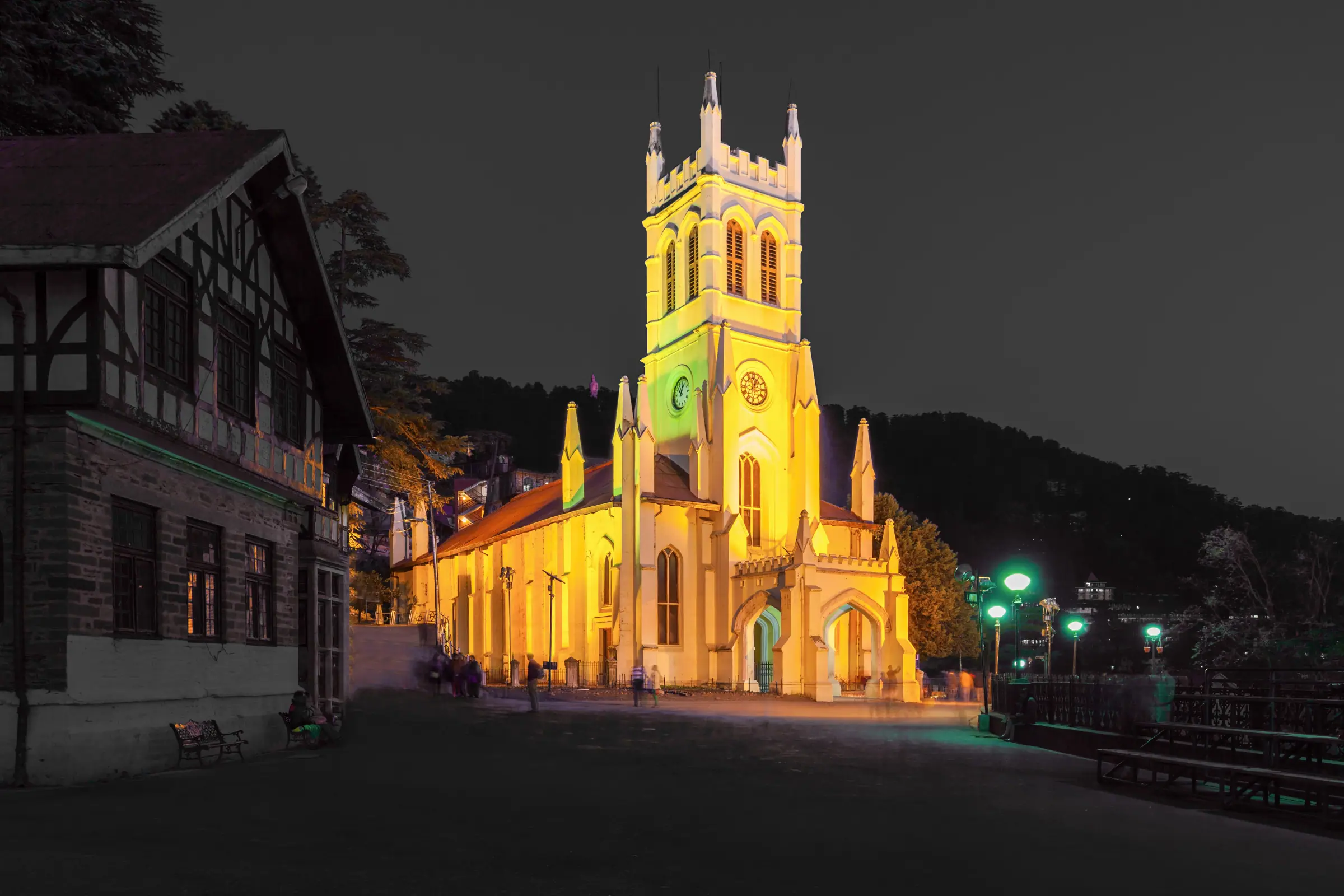
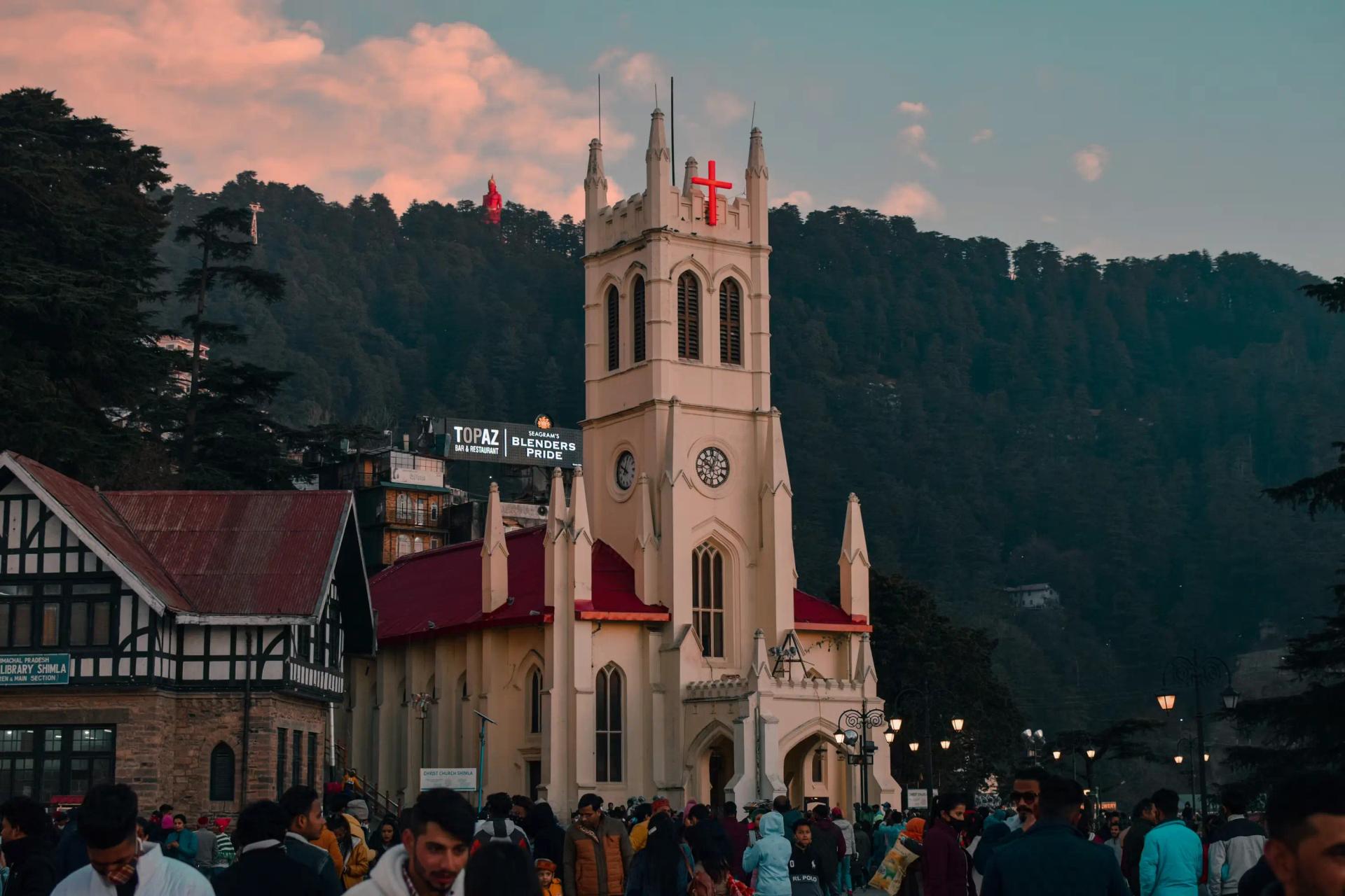
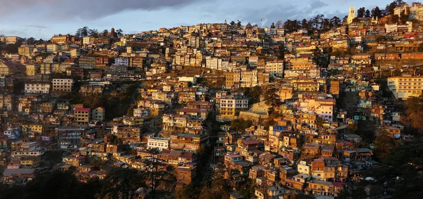
Chapter One — Chandigarh to Shimla to Kinnaur (Days 1–2): the circuit begins in Chandigarh — a planned city designed by Le Corbusier in the 1950s with the kind of geometric confidence that only a clean-slate mandate produces, and a city with a Sector 17 market worth half a day before the drive north begins. Shimla is 115 kilometres from Chandigarh, and the ascent from the plains to the 2,100-metre hill town takes the driving form of everything that followed: one lane in theory, the dimensions of a mountain goat path in practice, and views that appear through the treeline at intervals that are worth the patience. Shimla itself — the erstwhile summer capital of British India, the city whose name derives from Shyamalaya meaning 'blue house', home to the Viceregal Lodge that once housed the administrative apparatus of an empire — deserves more than the two hours most circuit travellers give it. The Jakhu Temple, at 2,455 metres above a deodar forest thick with monkeys, contains the 108-foot Hanuman statue visible from every corner of town. Christ Church (1857), the second-oldest church in north India, stands in Victorian Gothic at the end of the Ridge. The Kalka-Shimla toy train, a UNESCO World Heritage narrow-gauge railway, runs through 103 tunnels and across 864 bridges in its 96 kilometres of mountain charm. Give Shimla two nights.
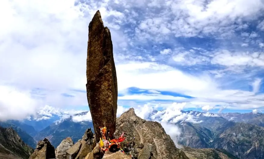
Chapter Two — The Hindustan-Tibet Highway and Kinnaur (Days 2–5): the road from Shimla east into Kinnaur follows NH-5, the old Hindustan-Tibet Highway, commissioned by Lord Dalhousie in June 1850 as a trade route to Tibet and now one of the most extraordinary drives in India. After Rampur Bushahr — where Sarahan's Bhimakali Temple, a 10th-century blend of pagoda and shikhara styles with golden towers above the Sutlej gorge, is the day's spiritual centrepiece — the road enters the gorge. Between Wangtu and Reckong Peo, the highway was carved through a series of cliff faces using techniques that would be considered impractical in most other countries; the resulting 'half-tunnels' — rock overhangs where one side of the road is cliff and the other is a thousand-metre drop — are among the most technically interesting road sections in India and among the most visually humbling. Go slowly. Do not overtake in the tunnels. Do not stop in the middle of the half-tunnel sections.
Malling Nala, near Nako, is the section that every experienced Kinnaur driver mentions first and mentions twice. An active landslide zone where the combination of snowmelt, geological instability, and monsoon water creates road conditions that change hour to hour, it is the most dangerous passage on the entire Shimla-to-Kaza route. BRO teams are permanently stationed here; in 2026, stabilisation work is ongoing. The rule is simple: attempt Malling Nala before 10 AM, when the road surface has had the night's cold to consolidate and before the day's melt has loosened the slopes above. Do not linger. Do not stop for photographs at the unstable section itself. The road through and beyond it to Nako, which sits at 3,625 metres beside its own small lake and monastery, is the reward — a transition from gorge to plateau that is among the more visually decisive moments of the entire circuit.
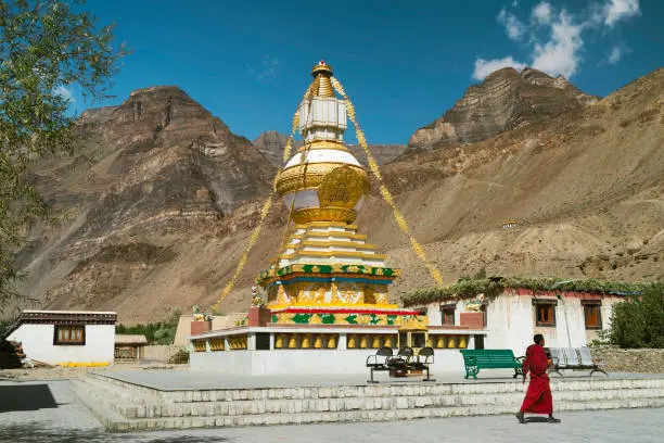
Chapter Three — Spiti: Tabo, Dhankar, Kaza, the monastery circuit (Days 6–9): Tabo Monastery, founded in 996 CE by Rinchen Zangpo under King Yeshe-Ö, is the oldest continuously functioning Buddhist monastery in the Himalaya. Over a thousand years of uninterrupted operation, through invasions and earthquakes and snowed-in winters. The murals on its interior walls — painted in a style that evolved from the Kashmiri-Tibetan synthesis that produced the great art of Ajanta — are described by art historians in a language usually reserved for the highest tier of world heritage. The Archaeological Survey of India oversees their protection. Flash photography is not permitted. Spend at least two hours here, ideally at both dawn and dusk.
Dhankar, 30 kilometres north of Tabo and 8 kilometres off the main road, is a thousand-year-old monastery balanced on a 300-metre spur of cliff at the confluence of the Spiti and Pin rivers — listed by the World Monuments Fund as one of the hundred most endangered heritage sites in the world. The conservation organisation working on its restoration has made progress, but the building's relationship with the cliff below it remains an exercise in geological faith. Arrive at golden hour. Walk the 45-minute trail to Dhankar Lake above the monastery. Return in time for the last light on the cliff face.
Kaza is the circuit's hub for two to three nights: the base for Ki Monastery at 4,166 metres (250 monks, annual Gustar festival in June/July), for the high-village loop of Kibber, Hikkim (world's highest operational post office), and Komic (4,520m, world's one of the highest motorable villages), for the fossil-hunting fields of Langza, and for the Pin Valley diversion — a side valley where the Wildlife Institute of India runs snow leopard survey operations and where the chance of a sighting in winter months is among the highest in India. For those extending to Chandratal Lake — the crescent-shaped glacial lake at 4,300 metres that is the Spiti circuit's closing visual statement — the road from Kaza via Losar to Kunzum Pass and then south to the lake requires a high-clearance vehicle and a full day. It is entirely worth it.
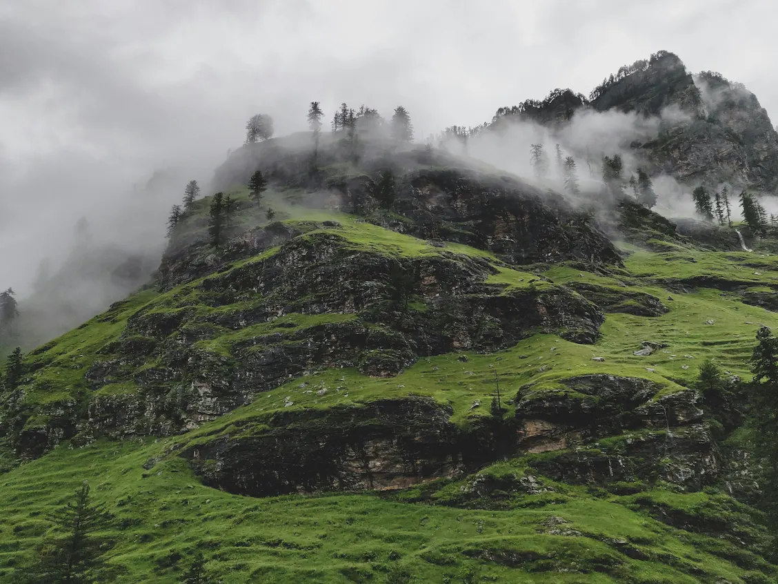
Chapter Four — The Kunzum Crossing and the Descent to Manali (Days 10–12): the Kunzum Pass crossing is the circuit's physical climax and its most demanding day. Fill the fuel tank completely in Kaza before departing — there is no fuel for 182 kilometres, until Manali. The road from Kaza to Losar is good; from Losar to the Kunzum summit (4,551m, with the small Kunzum Devi Temple where circuit travellers honk their horns once and circumambulate the shrine by custom) the gradient is gentler from the Kaza side than from the Manali side. The Kunzum Devi Temple at the top is where the circumambulation — a single clockwise round of the small shrine — is performed by almost everyone who crosses, regardless of religious commitment. It is not piety that drives this ritual among non-believers; it is the altitude, and the gratitude that altitude produces in people who have successfully reached it.
Below the summit, on the Manali side, the road changes character entirely. The section from Kunzum down to Batal and then the 60-kilometre corridor from Batal to Gramphu is the hardest driving on the entire circuit: a boulder-strewn, stream-crossed, GPS-unhelpful track that has been described by honest travel writers as a riverbed that a road occasionally crosses. The pagal nalas — the seasonal glacier-melt streams that cross the track at irregular intervals — are safest in the early morning before the day's sun has accelerated the melt above. Cross before 11 AM wherever possible. The boulder sections require low-gear, low-speed navigation; second guessing your vehicle's suspension is appropriate. Three to four hours is the standard time from Batal to Gramphu in good conditions. Allow five. Then the Atal Tunnel appears — 9.02 kilometres of well-lit, smooth-surfaced, world-record-holding tunnel that represents the most dramatic transition from rough to easy driving in India. You emerge at Sissu in Lahaul into a world of tarmac and signal bars and the Sissu waterfall, and Manali is forty-six kilometres away on excellent road.
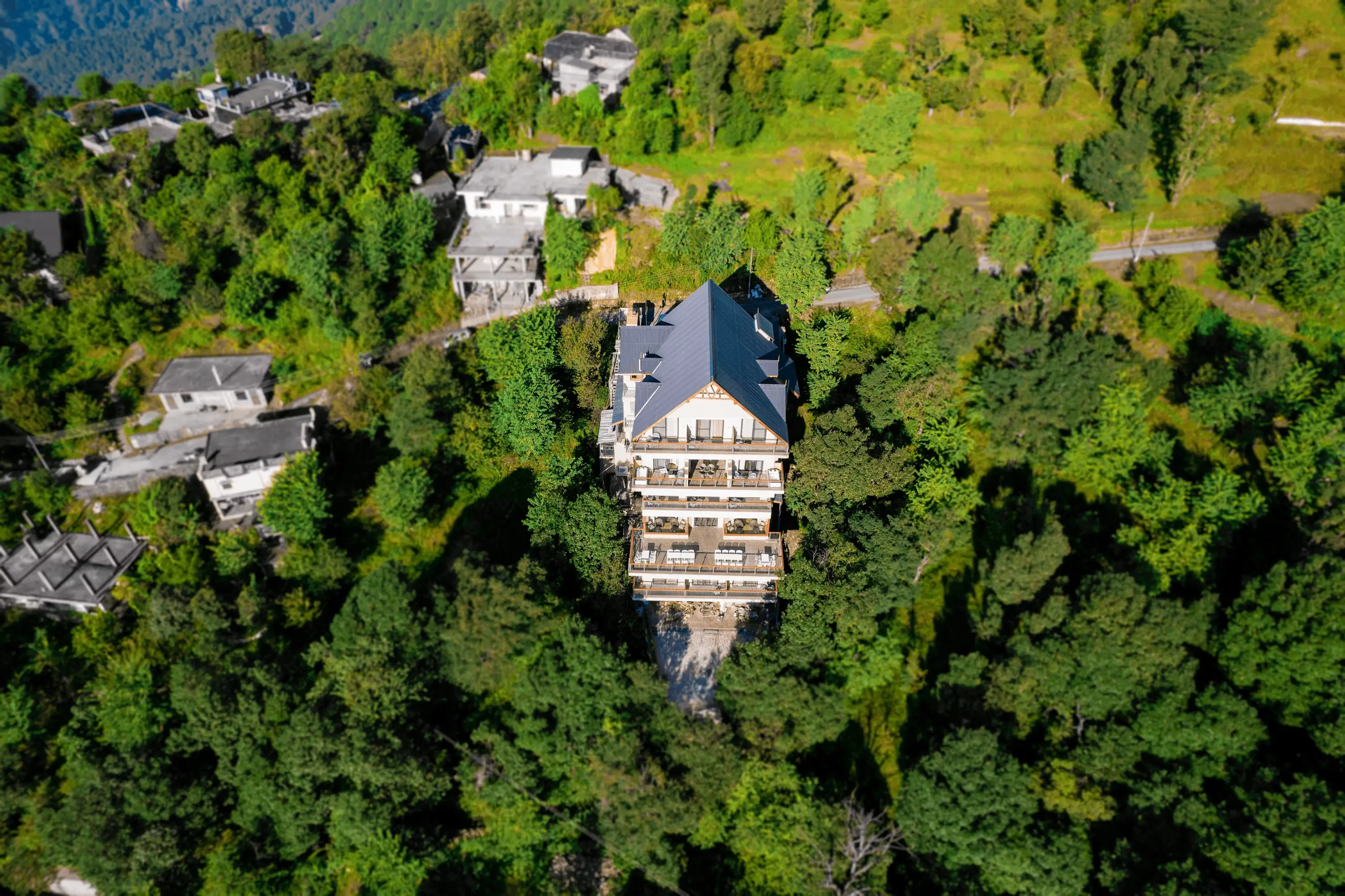
Chapter Five — Kangra Valley, McLeod Ganj, Dalhousie (Days 13–16): the descent from Manali into the Kullu Valley marks the circuit's emotional exhale. After ten days of high altitude, rough roads, and the specific mental engagement required by mountain driving, the NH-3 dual carriageway from Manali to Kullu is almost aggressively comfortable. Naggar Castle, 21 kilometres south of Manali — the 16th-century seat of the Kullu dynasty, now a heritage hotel and museum adjacent to the Nicholas Roerich Gallery — is the day's first stop and one of the most undervisited heritage properties in Himachal Pradesh. Then Kullu town, which frames the Beas River with orchards and the Kullu Dussehra festival in October (300+ village deities converging on the Dhalpur ground — if your timing allows, this is one of the most extraordinary events in Himachal). Then Bir Billing.
Bir, in the Kangra Valley, is the world's second-highest paragliding site: the take-off at Billing at 2,400 metres, the landing meadow in the Tibetan colony at 1,400 metres, 800 metres of altitude differential and the thermal currents that rise from the Kangra Valley floor combining to produce flying conditions that drew the 2015 Paragliding World Cup and the 2024 second World Cup India here. A tandem flight from Billing takes 25–30 minutes at full altitude, during which the Dhauladhar range is visible on one side and the Kangra tea gardens are visible on the other. The Tibetan colony in Bir, established in the 1960s by Chokling Rinpoche, adds a cultural dimension to the village that its adventure-sports reputation tends to overshadow. Give Bir two nights.
McLeod Ganj, 70 kilometres west of Bir through the Kangra tea-garden country and Palampur, is the Tibetan exile capital — the Tsuglagkhang complex, the Namgyal Monastery, the Tibet Museum, the morning kora. After the cold desert of Spiti, the lush sub-Himalayan landscape of the Kangra Valley and the dense spiritual infrastructure of McLeod Ganj constitute the circuit's most complete cultural contrast. Two nights here. Then Dalhousie, 115 kilometres west, for the Khajjiar meadow (the Swiss diplomat's signboard, the Khajji Nag Temple, the meadow circuit at dawn) and the Dainkund Peak trek and, if time allows, the Chamba town excursion for the Lakshmi Narayan Temple complex and the Bhuri Singh Museum's collection of Pahari miniatures. Then Pathankot, and the plains, and the return.
| SEGMENT | DISTANCE | ROAD QUALITY 2026 | CRITICAL NOTES |
|---|---|---|---|
|
Chandigarh → Shimla |
~115 km |
Excellent — NH-5 double lane |
Solan to Shimla: switchbacks but good tarmac; heavy truck traffic morning hours |
|
Shimla → Rampur Bushahr |
~130 km |
Good — NH-5 improves after Theog |
Kufri and Narkanda area: tourist traffic weekends; apple orchard country |
|
Rampur → Wangtu/Jeori |
~55 km |
Average — gorge begins |
Half-tunnels begin; single lane in sections; NH-5 carved into cliff; awe-inspiring and demanding |
|
Jeori → Tapri → Reckong Peo |
~50 km |
Average — landslide-prone zone |
BRO active maintenance; loose gravel after monsoons; Tapri has last reliable fuel before Peo |
|
Reckong Peo → Pooh |
~40 km |
Average to good — tight cliff curves |
Stunning Sutlej gorge; Kinnauri apple orchards; single lane in places |
|
Pooh → Nako (via Malling Nala) |
~30 km |
AVERAGE TO POOR — most dangerous section |
Malling Nala: active landslide zone; closures possible for hours to days; always attempt before 10 AM; BRO clearance ongoing |
|
Nako → Sumdo → Tabo |
~50 km |
Good to average |
Road quality improves entering Spiti; Sumdo is HP district border marker; dramatic river confluence |
|
Tabo → Kaza |
~47 km |
Good to average — Shichilling section |
Shichilling below Dhankar receives heavy snowfall; main bottleneck between Tabo and Kaza in winter |
|
Kaza → Losar → Kunzum Pass (4,551m) |
~50 km |
Good to average then ROUGH |
Good road from Kaza to Losar; Losar to Kunzum top: better than Manali side; gentler gradient |
|
Kunzum Pass → Batal → Gramphu |
~60 km |
VERY ROUGH — boulder riverbed |
The hardest road on the entire circuit; '60km of pure off-road' per experienced bikers; pagal nalas in afternoon — cross before 11 AM; high-clearance 4WD essential |
|
Gramphu → Atal Tunnel → Manali |
~46 km |
Good to excellent — Atal Tunnel bypasses Rohtang |
Drive through 9.02km Atal Tunnel; emerges at Sissu in Lahaul; then excellent NH-3 to Manali |
|
Manali → Kullu → Bir Billing |
~115 km |
Good — NH-3 dual carriageway Manali to Kullu |
Kullu to Bir: NH-154 valley road; Bir village approach: single-lane hill road fine for cars |
|
Bir Billing → Dharamshala |
~70 km |
Good — NH-503 via Palampur |
Tea gardens at Palampur; good visibility road; Dharamshala approach from east is fine |
|
Dharamshala → Dalhousie |
~115 km |
Good — NH-503 and district roads |
Chamba district; mountain roads but well-maintained; some single-lane sections after Banikhet |
|
Dalhousie → Pathankot → Chandigarh |
~330 km |
Good — plains NH post-Pathankot |
Pathankot to Chandigarh: flat, fast, uneventful NH-44 section; allow 5–6 hrs |
ROAD CONDITIONS — SEGMENT-BY-SEGMENT 2026
THE BATAL TO GRAMPHU SECTION IS THE MARS BAR HIDDEN INSIDE A BOX OF CHOCOLATES — EVERYTHING BEFORE IT IS SMOOTH, LAYERED, AND BEAUTIFULLY STRUCTURED. THEN YOU BITE INTO THIS ONE SECTION AND IT IS COMPLETELY DIFFERENT: DENSE, CHEWY, TESTING, DEMANDING. AND SOMEHOW THE MOST MEMORABLE THING IN THE WHOLE BOX.
Things to do at each stop...
Shimla — the Queen of Hills — the Viceregal Lodge (now the Indian Institute of Advanced Study) at Observatory Hill is the finest building in Shimla and the most instructive: a Scottish baronial mansion of 1888 that housed the summer government of the British Raj and now hosts academic seminars, its corridors and study rooms unchanged from the period when treaties that altered the map of Asia were signed within its walls. The Jakhu Temple at 2,455 metres, reached by a 2.5-kilometre forest path (or the Jakhu ropeway), is sacred to Lord Hanuman and surrounded by the monkey population that makes Jakhu simultaneously the most charming and most reliably inconvenient walk in the city. The Kalka-Shimla toy train — a 96-kilometre, 5-hour, 103-tunnel UNESCO World Heritage railway that runs daily from Kalka Junction — is the correct way to arrive in Shimla if your itinerary permits it. Take it one way, drive the other.
Sarahan — Bhimakali Temple — the temple complex at Sarahan is among the finest religious buildings in Himachal Pradesh and is visited by a fraction of the people who pass through on their way to Kinnaur. The Bhimakali Temple — its golden spire visible from the road below — represents a unique architectural synthesis: the lower floors are in Himachali pagoda style with carved wooden panels and slate roofs; the upper sanctuary follows a modified shikhara plan. The goddess Bhimakali — a form of Durga who is simultaneously local deity and Shakti manifestation — has been worshipped here since at least the 10th century. Entry requires leaving shoes and leather at the gate; the inner courtyard has a stillness that the entire Spiti circuit builds on rather than replacing.
Chitkul — the last village — the road-end at Chitkul, 3,450 metres above sea level, is two kilometres from the Nagasti ITBP post and approximately 6,194 kilometres from Bern, Switzerland (according to the Khajjiar signboard, which is not relevant here but feels somehow connected). The Mathi Devi Temple at the village centre, the wooden houses, the Baspa River below, and the snow peaks at the valley head constitute one of the finer visual compositions available without a trekking permit in India. The walk to the Nagasti post takes 45 minutes and brings you to the place where civilian India ends.
Tabo, Dhankar and the Spiti monastery circuit — covered in detail in the separate articles on Ki, Tabo, Dhankar and Komic (for those using this guide in conjunction with the full Spiti Monastery Circuit article). The essential circuit from Kaza: Ki Monastery at dawn, Kibber wildlife, Hikkim post office, Komic village, Langza fossils, Dhankar Lake trek, and Tabo murals. Allow three full days in Kaza for the circuit without rushing.
Chandratal Lake — the moon lake — Chandratal, the crescent-shaped lake at 4,300 metres in the Lahaul-Spiti district, takes its name from the crescent moon shape that the shoreline traces —
Chandra means moon; tal means lake. The approach from the Kaza side via Losar is cleaner and more direct than from the Batal-Manali side; both require a high-clearance vehicle for the final kilometres. No camping is permitted within one kilometre of the shoreline under the 2026 regulations; camps are established at the designated zone beyond this boundary. The stargazing at Chandratal, at this altitude and in this degree of removal from any light pollution, is the most densely populated sky many visitors will ever see above them. Stay overnight.
Bir Billing — flight from the world's second-highest site — the logistics of a Bir Billing paragliding flight: arrange with a licensed operator either on the landing meadow in Bir or online in advance. The operator's vehicle takes you up the 14-kilometre road from Bir to Billing in 30 minutes. The take-off is from the meadow at Billing at 2,400 metres; the tandem flight, with a certified pilot managing the wing, takes 25–30 minutes and covers approximately 800 metres of altitude drop to the landing fields in Bir's Chowgan village. The Dhauladhar is behind you on the Billing side; the Kangra Valley and its patchwork of tea gardens is below and ahead; the thermal lift that makes Billing exceptional means the flight extends rather than drops as soon as the wing is in the air. Cost: ₹2,500–4,000 for the full tandem flight including Billing transfer.
| STOP | ALTITUDE | WHAT TO DO | BEST FOR | STAY |
|---|---|---|---|---|
|
Shimla |
2,100 m |
Viceregal Lodge; Jakhu Temple (108-ft Hanuman statue); Christ Church (1857, 2nd oldest in N India); Mall Road; Scandal Point; Kalka-Shimla toy train |
Colonial heritage; hill station charm; first night base |
2 nights (do justice to it) |
|
Sarahan |
2,165 m |
Bhimakali Temple (golden towers; 800 CE; Himachali pagoda-shikhara blend); apple orchards; Sutlej valley views |
Religious architecture; orchard landscapes |
1 night |
|
Sangla and Chitkul |
2,680 m / 3,450 m |
Kamru Fort (Bushahr capital); Batseri riverside walk; Chitkul (road's end before Tibet); Rakcham viewpoint |
India's last village; Baspa Valley grandeur; Kinner Kailash views |
1–2 nights |
|
Reckong Peo / Kalpa |
2,290 m / 2,960 m |
Kalpa village (Kinner Kailash backdrop); Suicide Point viewpoint; Roghi village; Reckong Peo market (ATM, fuel) |
Kinner Kailash sacred peak views; administration hub for foreign PAP |
1 night Kalpa |
|
Nako |
3,625 m |
Nako Lake (high-altitude village lake); Nako Monastery (Lotsawa Lhakhang, 11th C) |
First high-altitude acclimatisation night; ancient monastery |
1 night |
|
Dhankar |
3,894 m |
Cliff monastery (World Monuments Fund endangered list); Dhankar Lake trek (45 min, 2km); Pin-Spiti confluence views |
One of the most dramatic locations in Indian Himalaya |
Day visit from Kaza or Tabo |
|
Kaza |
3,800 m |
Circuit base for Spiti loop; Ki Monastery (4,166m; 250 monks); Kibber wildlife; Komic (4,520m, highest motorable village); Langza fossils; Hikkim post office |
Spiti culture hub; monastery circuit; high-village loop |
2–3 nights |
|
Chandratal Lake |
4,300 m |
Crescent-shaped glacial lake; star gazing; camping (outside 1km limit); sunrise on the lake |
One of India's most beautiful lakes; celestial sky photography |
1 night (camp or Batal dhaba) |
|
Manali |
2,050 m |
Hadimba Temple; Old Manali lanes; Vashisht hot springs; Solang Valley; Rohtang Pass (permit); Naggar Castle (21km) |
Adventure base; culture; rest after rough Spiti roads |
2 nights (recovery after Batal–Gramphu) |
|
Bir Billing |
1,400 m / 2,400 m |
World's 2nd highest paragliding site (hosted World Cup 2015 & 2024); Tibetan colony; monasteries; Billing trek (3–4 hrs up); tea garden country |
Paragliding; Tibetan culture; Kangra Valley views from 2,400m |
1–2 nights |
|
McLeod Ganj |
1,770–2,082 m |
Tsuglagkhang (Dalai Lama temple); Tibet Museum; morning kora; Triund trek; Norbulingka Institute (18km); café culture |
Tibetan exile capital; spiritual depth; cultural contrast to Spiti |
2 nights |
|
Dalhousie and Khajjiar |
1,970 m / 1,920 m |
Khajjiar meadow ('Mini Switzerland', signboard 6,194km to Bern); Dainkund Peak (Singing Hill, 2,755m); Bakrota Hills walk; Chamba town day trip |
Pastoral beauty; colonial hill station; world-famous meadow |
1–2 nights |
|
Chamba town |
920 m |
Lakshmi Narayan Temple complex (10th century); Bhuri Singh Museum (miniature Pahari paintings; Chamba rumal UNESCO textiles); Chaugan ground; Ravi riverside |
Ancient royal capital; finest temple complex in Chamba district; mandatory if staying in Dalhousie |
Day trip from Dalhousie |
|
Tabo |
3,280 m |
Tabo Monastery (996 CE; oldest continuously functioning; Ajanta-quality murals); meditation caves above village |
'Ajanta of the Himalayas'; Buddhist scholarship; cave meditation spaces |
1 night |
KEY STOPS ON THE NORTHERN CIRCUIT
STANDING AT SUMDO CHECKPOINT BETWEEN KINNAUR AND SPITI IS LIKE REACHING THE CENTRE OF A TOBLERONE — YOU KNOW THERE ARE MORE TRIANGLES TO COME, YOU HAVE ALREADY CONSUMED THE ONES BEHIND YOU WITH GREAT SATISFACTION, AND THE SPECIFIC COMBINATION OF ALTITUDE AND EXPECTATION AT THIS PARTICULAR POINT IS WHAT MAKES THE WHOLE STRUCTURE HOLD TOGETHER.
Things not to do on the northern circuit...
Do not enter Spiti from the Manali side on your first day — the altitude jump from Manali (2,050m) to Kunzum Pass (4,551m) in a single day is the most common cause of trip-ruining AMS on the Himachal circuit. Every experienced guide, operator, and repeat traveller recommends the Shimla entry for precisely this reason. If your itinerary forces a Manali entry, spend three nights in Manali before attempting Kunzum, take the first day to Sissu only, and do not push to Kaza in a single day from Manali under any circumstances.
Do not drive the Batal–Gramphu section after 1 PM — the pagal nalas — seasonal glacier-melt streams that cross the track between Batal and Gramphu — are at their calmest and shallowest in the early morning, when the overnight cold has slowed the melt above. By 2–3 PM, the afternoon sun has melted a full day's worth of glacier ice into those streams; the depth and speed of the water at the crossings increases significantly. This is the section where vehicles get stuck and where BRO assistance, if available, takes time to arrive. Leave Kaza or Batal by 5–6 AM, reach Gramphu before noon. The Atal Tunnel is then forty-six kilometres of relief.
Do not attempt Malling Nala after a day of rain or during active snowmelt — the Malling Nala section near Nako is the Kinnaur route's most unpredictable passage, and it responds to precipitation with a speed that can transform a manageable road into a closed one within hours. Check the BRO X account and local police WhatsApp groups in Reckong Peo for that morning's Malling Nala status before attempting it. If there is doubt, wait. The delay is measured in hours; the alternative, if you drive through a fresh slide, is measured in days.
Do not skip the e-Aagman registration — the checkpost at the Atal Tunnel will require it, and the nearest WiFi that allows you to complete it retroactively is back in Manali. The registration takes five minutes with a working internet connection and is enforced without exception. Complete it the evening before you cross into Lahaul-Spiti.
Do not rely on Jio or Airtel for navigation between Gramphu and Losar — the approximately 100-kilometre stretch from Gramphu (post-Atal Tunnel, heading to Kunzum) to Losar (first village in Spiti, heading to Kaza) has essentially no mobile signal on Jio or Airtel networks. Google Maps and other data-dependent navigation apps are useless in this zone. Download offline maps — Maps.me or OsmAnd, with HP state maps including the Spiti district — before leaving Manali or Kaza. BSNL has occasional patches. Do not reach the Batal side of Kunzum at 4 PM with a dead battery and no offline map.
Do not schedule Triund for a peak-season weekend day in McLeod Ganj — the Triund trail from Gallu Devi Temple becomes seriously crowded on summer weekends. Go on a Tuesday or Wednesday morning, starting before 7 AM, to have the ridge to yourself. The 22 curves of the final ascent are hard enough in themselves without adding a human traffic jam to the experience.
Do not forget to fill fuel completely in Kaza — the Kaza to Manali distance via Kunzum Pass and the Atal Tunnel is approximately 182 kilometres. There is no fuel available anywhere between Kaza and Manali. The Kaza ATM also runs out periodically in peak season; withdraw a generous cash sum here. Both of these are facts that enough travellers discover mid-journey, in expensive and stressful ways, that they deserve explicit inclusion in any honest northern circuit guide.
| PERMIT / FEE | WHO | COST (2026) | WHERE / HOW | NOTES |
|---|---|---|---|---|
|
HP vehicle entry toll |
All vehicles registered outside HP |
₹100/day per vehicle |
Collected at state border checkpoints |
New from April 1, 2026; applies to private cars, SUVs; valid for 7-day stay options available |
|
e-Aagman registration |
All vehicles entering Lahaul-Spiti district |
Free/Nominal |
Online portal before entry — mandatory |
Required for Manali side (Atal Tunnel) and Kunzum approach; enforced at Atal Tunnel checkpost |
|
Rohtang Tourism Permit |
All tourist vehicles visiting Rohtang (not Atal Tunnel) |
₹550 (₹500 + ₹50 congestion) |
hp.gov.in portal; book night before; opens 10 AM for next day |
1,200 vehicles/day cap; CLOSED EVERY TUESDAY; vehicles >10 yrs rejected; printout compulsory |
|
Beyond Rohtang Permit |
Vehicles going past Rohtang to Spiti/Lahaul/Leh |
₹50 (congestion only) |
Same hp.gov.in portal |
No vehicle cap; use if driving Manali → Kunzum without stopping at Rohtang for tourism |
|
PAP (Protected Area Permit) |
Foreign nationals only — for Kinnaur restricted zones (past Jangi/Wangtoo) and entire Spiti |
₹250–400 |
SDM Reckong Peo (best for Shimla route); Manali SDM; Kaza ADC office |
Indians need ZERO permits for entire Spiti and Kinnaur; carry valid photo ID only |
|
GHNP Core Zone Permit |
All visitors to Great Himalayan National Park core zone (Tirthan side) |
₹100 Indian / ₹400 foreigner + guide fee |
Sai Ropa Forest Office, Tirthan Valley |
Mandatory registered guide for core zone treks; ecozone (Gushaini area) is free, no guide needed |
|
Chandratal entry fee |
All vehicles visiting Chandratal Lake |
₹150 Indian / ₹500 foreigner |
Online portal or at barrier |
Only accessible by high-clearance vehicle; no overnight camping within 1km of lake shore |
|
SADA fee (Spiti) |
All tourist vehicles entering Spiti |
₹100–400 depending on vehicle type |
Collected at Sumdo/Kaza barrier |
Local development fund; separate from HP state toll |
|
Manali Green Tax |
All out-of-state vehicles in Kullu-Manali |
Included in state toll / separate levy |
At Kullu barrier or online |
Valid for 7 days from date of entry |
PERMITS AND REGULATORY NOTES — 2026
Fuel stops and logistics...
The fuel map of the northern circuit is one of its most critical planning documents and one of the least discussed in most travel writing about the region. The longest fuel-free stretch is the 182 kilometres from Kaza to Manali — a section that includes the roughest road on the circuit (Batal to Gramphu) and the highest pass (Kunzum, 4,551m). Fill the tank completely in Kaza before departing for Kunzum. If your vehicle has a small tank or poor fuel economy, carry a jerry can with 5–10 litres of reserve. This is not a precaution against unusual circumstances; it is standard practice for the Kaza–Manali crossing.
On the Kinnaur side, the fuel logic runs: top up in Shimla (Day 1), top up in Rampur (Day 2), check at Tapri (the last reliably-stocked pump before Reckong Peo), and fill completely at Reckong Peo before heading to Nako and beyond. The stretch from Reckong Peo to Kaza — through Nako, Tabo, and Dhankar — has no reliable fuel. Kaza itself has a fuel pump but it runs on allocation; arrive in the morning before the daily allocation is depleted, and note that during peak season the pump can run dry by afternoon.
| LOCATION | ON ROUTE | NOTES |
|---|---|---|
|
Chandigarh |
Circuit start |
Fill full; last reliable city fuel prices |
|
Shimla |
Day 1 stop |
Fill up here; options multiple |
|
Rampur Bushahr |
Day 2 en route |
Fill here before entering Kinnaur gorge |
|
Tapri |
NH-5 on Kinnaur route |
Last reliable pump before Reckong Peo; note before Malling Nala section |
|
Reckong Peo |
Day 4 base |
IMPORTANT fill-up before Nako/Spiti push; last reliably-stocked pump until Kaza |
|
Kaza |
Spiti base |
CRITICAL fill-up before Kunzum crossing; next pump is Manali, 182km away with no options en route |
|
Manali |
Day 11 stop |
Fill up fully; last major pump before Kullu/Kangra circuit continues |
|
Kullu town |
Day 13 en route |
Fuel available; good stocks |
|
Dharamshala |
Day 14 stop |
Multiple pumps in town |
|
Pathankot |
Return leg |
Last HP pump before returning to Punjab/Delhi |
FUEL STOPS — CRITICAL LOGISTICS
Responsible travel on the northern circuit...
The Himachal Pradesh plastic ban of 2026 is the most significant recent development in responsible travel in the state, and it applies specifically to this circuit's most fragile environments: Spiti's cold desert, the Chandratal Lake shore, the Kunzum Pass ecosystem, and the Tirthan Valley buffer zone of the Great Himalayan National Park. A LifeStraw bottle or quality filter eliminates any need for plastic water purchases across the entire circuit. This is not merely compliance — in Spiti, where the visible consequence of plastic waste on an arid landscape is extreme, it is a material contribution to the quality of a place that exists precisely because so few people live there.
Spend locally at every opportunity. The homestay network of the Baspa Valley, Tabo village, and the Kaza area represents the economic model that keeps young Spitians in the valley rather than migrating to the plains. The monks at Tabo and Ki and Dhankar maintain institutions of extraordinary cultural significance on budgets that would not cover the monthly operating costs of a mid-tier restaurant in Delhi. Pay the photography fee at every monastery that charges one, pay the entry fee at every heritage site that levies one, and pay the guide fee for the GHNP core zone without attempting to negotiate it away.
The Great Himalayan National Park — 1,171 square kilometres of virgin forest at the circuit's Tirthan Valley extension point, a UNESCO World Heritage Site since 2014 — asks one thing of visitors above all others: the registered guide requirement for core zone access is not negotiable and should not be attempted to be negotiated. The fee is ₹100 for Indians. The guide's knowledge of the park's wildlife, trails, and seasonal conditions is worth considerably more than that. The ecozone at Gushaini, which requires no permit and no guide, is freely accessible and gives a genuine sense of what the park contains without the full-day commitment of a core zone trek.
Before you go — and what BizareXpedition can build for you...
The northern circuit requires, at minimum, 14 days to do with any justice to its individual chapters. Seventeen to eighteen days allows breathing room — an extra night in Shimla, a rest day in Kaza, an afternoon in Bir Billing that is not the afternoon on which you also drove 115 kilometres from Manali. Twenty-one days is the ideal for those who want to add the Tirthan Valley (2 nights at Gushaini for the GHNP ecozone and trout fishing and the quiet that McLeod Ganj and Manali cannot offer) or a proper Chamba town excursion rather than a rushed day trip from Dalhousie.
The planning complexity of this circuit is real. The road status changes with the season and the weather; the permits are layered and format-specific; the acclimatisation logistics require sequencing that most first-time visitors don't have the experience to get right; the fuel stops must be pre-planned rather than improvised; the accommodation in Spiti — particularly at Chandratal and Nako — books out weeks in advance during peak season. Getting any of these wrong doesn't merely inconvenience a trip; it can strand a vehicle 100 kilometres from the nearest fuel pump at altitude with no mobile signal.
BizareXpedition™ Services Pvt. Ltd. (bizarexpedition.com), based in Haridwar and specialising in Himalayan journeys of every register — pilgrimage, honeymoon, adventure, cultural — designs fully customised northern circuit itineraries that sequence every chapter correctly, build the permit applications into the departure timeline, and ensure that the accommodation, fuel, and acclimatisation logistics are planned rather than improvised. For self-drivers who want expert oversight without losing the independence of driving their own vehicle, for group road trips that need a well-researched framework, or for those who would prefer to be driven through the circuit entirely — BizareXpedition's knowledge of this road is ground-level, seasonal, and current.
| ITEM | NOTES |
|---|---|
|
e-Aagman registration |
Complete BEFORE driving to Lahaul-Spiti — mandatory at Atal Tunnel checkpost |
|
Rohtang permit |
Book at hp.gov.in the evening before; permits release at 10 AM; sell out in 2–5 mins in May-June; closed Tuesdays |
|
Vehicle age check for Rohtang |
Vehicles >10 years auto-rejected; Atal Tunnel has no restriction |
|
PAP for foreigners |
Collect at SDM Reckong Peo BEFORE crossing into restricted zones; same-day processing; bring passport + 2 photos + visa |
|
Offline maps |
Download HP state maps on Maps.me or OsmAnd BEFORE entering Spiti — no internet from Gramphu to Losar (~100km); Google Maps unresponsive offline |
|
BSNL SIM |
Best coverage across Kinnaur and Spiti; Jio absent; Airtel partial; get BSNL SIM in Shimla or Chandigarh |
|
Cash |
Fill at Reckong Peo (last ATM before Kaza); Kaza ATM runs out in peak season — withdraw ₹10,000+ here; no ATMs Kaza to Manali |
|
LifeStraw / filter |
HP enforces single-use plastic ban 2026; glacier water in Spiti is clean after filtering; carry reusable bottle |
|
Fuel carrier (jerry can) |
Strongly recommended for Kaza–Kunzum–Gramphu–Manali leg (182km, zero fuel stops) |
|
Puncture repair kit + tow rope |
Essential for Batal–Gramphu boulder section; roadside assistance non-existent; BRO helps but only if nearby |
|
First aid + altitude medicine |
Diamox (acetazolamide) on doctor advice for Kunzum (4,551m); acclimatise 2 nights in Kaza before crossing; descent solves AMS |
|
Warm clothing for all months |
Kunzum and Chandratal: 0–5°C even in July; Nako nights: below 5°C; carry down jacket and thermals regardless of summer booking |
|
Start times |
Leave every high-altitude segment base by 6 AM: pagal nalas on Batal–Gramphu section safest before 11 AM; Rohtang summit clouds by noon |
|
Emergency contacts |
HP Tourism Helpline: 1800-180-8080; Kaza ITBP: 01906-222210; Reckong Peo Police: 01786-222201; Manali Police: 01902-252126 |
PRACTICAL CHECKLIST — FULL NORTHERN CIRCUIT
| CATEGORY | BUDGET (₹/DAY/PERSON) | MID-RANGE (₹/DAY/PERSON) | PREMIUM (₹/DAY/PERSON) |
|---|---|---|---|
|
Accommodation |
700–1,200 (homestays; monastery guesthouses; Zostel) |
1,500–3,000 (boutique guesthouses; Toshim Homestay-tier) |
4,000–15,000+ (Banjara Camp; luxury resorts in Manali/Shimla) |
|
Food |
300–500 (daal-rice; thukpa; homestay meals) |
600–1,000 (café meals; trout; restaurant dinners) |
1,200–2,500 (resort dining; Shimla restaurant) |
|
Vehicle costs (fuel, shared per 4 pax) |
600–800 (fuel share; SUV ~12 litres/100km; ₹100/litre diesel) |
800–1,200 (inc. permit fees, tolls, SADA per day) |
1,500–2,500 (hired SUV with driver ~₹3,000–4,500/day split) |
|
Activities & permits |
200–400 (Rohtang ₹550 per vehicle; Chandratal ₹150/person) |
500–1,000 (Bir paragliding short fly; monastery fees) |
2,500–5,000 (full paragliding package; guided treks; jeep safaris) |
|
Total per day estimate |
₹1,800–2,800 |
₹3,500–6,000 |
₹8,000–25,000+ |
BUDGET GUIDE — PER PERSON PER DAY ON CIRCUIT
The checkpoint at Sumdo is not a dramatic place, but it is a precise one. Behind it, the gorge and the half-tunnels and the apple orchards and the temple with the golden towers and the last village before Tibet. Ahead, the oldest monastery in the Himalayas and the road that climbs to 4,551 metres and the lake shaped like the crescent moon and the corridor of boulders that tests every vehicle's suspension and the world's second-highest paragliding site and the hill town where a Tibetan exile has been running for sixty-five years without losing its belief that it will one day end. The checkpoint officer looks at the photo ID, nods, lifts the barrier. You drive through. The circuit continues.
Best Selling Tour Packages
Explore other exciting options for your next adventure!