

Karan
Writer
Updated On - Jul 16, 2026
25 min
Published On - Jul 03, 2026
Sangla and Chitkul — The Last Village Before Tibet
A valley where the apple orchards end and the border begins. Where a thousand-year-old fort houses every god in the Hindu pantheon and the road simply stops at a village of 600 souls, beyond which the earth belongs to the Indo-Tibetan Border Police and the mountains.
The road ends at a wooden sign. It is not a dramatic sign — no skull and crossbones, no red barricade, no armed checkpoint, just a painted board in Hindi and English beside a rough stone wall at the edge of Chitkul village, and beyond it, a dirt track that curves around the mountain and disappears. This is where India stops. Not with a wall, not with a ceremony, but with a sign and a river and a sky that seems, at 3,450 metres, to be about thirty per cent closer than the sky you are used to. I have been standing here for twenty minutes, looking at the track that leads to the Nagasti ITBP post two kilometres away, and trying to understand the specific quality of silence that belongs to the end of a country.
Chitkul is the last inhabited village on the old Hindustan-Tibet Road — the ancient trade route along which wool, salt, dried apricots, horses, and Buddhist manuscripts travelled between the plains of India and the high plateau of Tibet for centuries before the road was closed, the border was drawn, and the pass at Shipki La became a line on a political map. The Baspa River runs cold and fast below the village, fed by glaciers you can see from the main street, and the Kinner Kailash massif — the sacred mountain that dominates the entire valley — stands at 6,050 metres to the northwest, its natural Shivlingam said to change colour from red at dawn to gold in daylight to silver by moonrise. This is not incidental mythology: the mountain is the reason the valley exists in the consciousness it does, and the reason the people who live here have maintained, for centuries, a relationship with the divine that is as practical and immediate as the relationship between an apple orchardist and the weather.
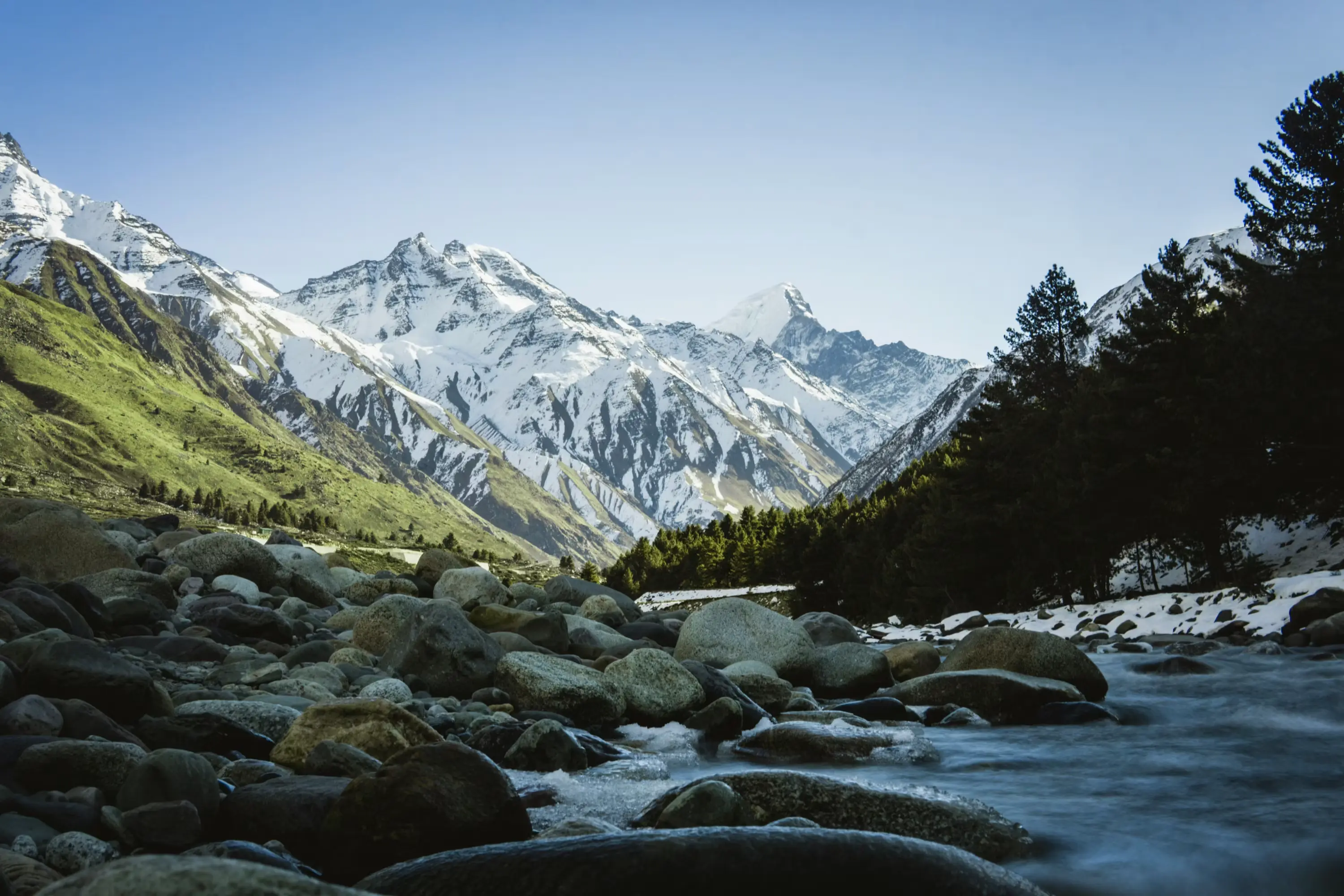
The journey to Chitkul passes through Sangla first, and it should. Sangla — capital of the Baspa Valley, seat of the ancient Bushahr kingdom before the capital moved downstream to Rampur, home to the extraordinary Kamru Fort and the broader landscape of apple orchards, terraced fields, and Kath Kuni wooden architecture that defines the valley's visual character — is where you understand what Chitkul's quieter, starker character is in relation to. The two places are twenty-eight kilometres apart and they feel like different chapters of the same book: Sangla is richly illustrated, full of detail, welcoming; Chitkul is the final page, almost entirely white, with just a few words that mean more than the rest.
The Geography of the Baspa...
Kinnaur — the district in which Sangla and Chitkul both sit — is one of the least understood corners of Himachal Pradesh, and this is largely a matter of road geometry. The Sutlej Gorge that carries NH-5 (the old Hindustan-Tibet Highway, commissioned by Lord Dalhousie in June 1850) through the district is one of the most dramatic road journeys in India: the highway is carved into sheer cliff faces, suspended above a river that drops through increasingly narrow gorges, and punctuated by tunnels through rock spurs so precipitous that the road-builders ran out of room on the cliff and had to go through. The effect is that Kinnaur feels inaccessible in a way that its geography, once understood, does not entirely justify. The valley is there. The road gets you in. You just have to be willing to take the road seriously.
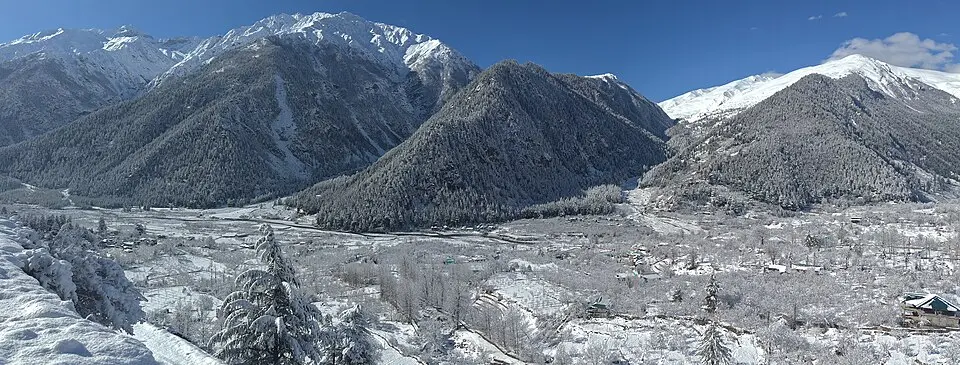
The Baspa River — locally, the valley it flows through is called the Tukpa Valley — turns off the main Sutlej corridor at Karcham, where a bridge carries you from NH-5 into a world that almost immediately feels different. The gorge narrows in the first few kilometres after Karcham with such drama that it seems to be testing your nerve before it opens out, around Sangla, into the broad, sunlit, apple-orchard valley that has made this corner of Kinnaur one of the most photographed landscapes in Himachal Pradesh. The Baspa runs along the right bank as you drive up; the orchards cover the flood plains on both sides; the snow peaks rise at the valley head; and the entire composition, in the golden light of a September morning or the clear brilliance of a May afternoon, is one of the most satisfying natural arrangements this country has to offer.
The cultural landscape of the Baspa Valley is a direct inheritance from the ancient Bushahr kingdom — the rajya whose capital was at Kamru village, just above Sangla town, before it moved to Rampur on the Sutlej. The Bushahr kings traced their lineage to Pradyumna, son of Lord Krishna, and maintained their grip on trade through the Hindustan-Tibet Road for several centuries, controlling the flow of wool, salt, and dried fruit between Tibet and the Indian plains. The fort at Kamru — their seat of power, their coronation hall, and their religious centre — enshrines the Kamakhya Devi whose idol, local tradition holds, was carried all the way from Guwahati in Assam at the Bushahr kings' command. That a Shakti shrine from the far northeast of India sits inside a Himalayan fort overlooking Tibetan Buddhist territory says something accurate about the cultural syncretism of Kinnaur: this is a place where Hinduism and Buddhism have coexisted for long enough that the distinction between them, for ordinary purposes, has blurred into something richer than either tradition alone.
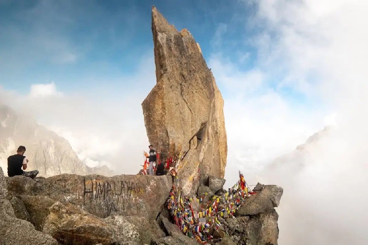
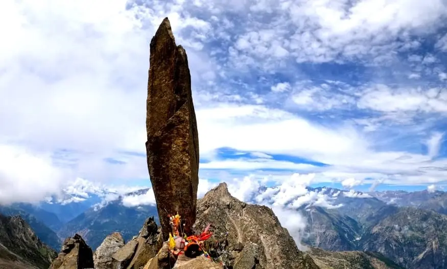
Kinner Kailash — the peak at 6,050 metres that presides over the entire valley system — is the most sacred site in this cosmology, venerated as one of the five Shiva Kailash peaks of the Himalayas, the winter abode of Lord Shiva and Parvati, and home to a natural 79-foot vertical rock formation known as the Shivlingam. Both Hindu and Buddhist Kinnauris revere it. The mountain is never discussed in Kinnaur the way a mountain would be discussed elsewhere — as a height to be measured or a challenge to be climbed. It is discussed as a presence: watchful, occasionally benevolent, always requiring acknowledgement. The Kinner Kailash Parikrama — a 60-kilometre circumambulation of the massif undertaken by pilgrims in July, August and September — is one of the most demanding and most significant religious journeys in north India, completed by thousands of devotees each year on the principle that circling the mountain burns karmic debt and grants something like proximity to the divine.
| FACT | DETAIL |
|---|---|
|
Valley |
|
|
River |
Baspa River — tributary of the Sutlej |
|
Sangla altitude |
2,680 m (8,793 ft) |
|
Chitkul altitude |
3,450 m (11,319 ft) |
|
Rakcham altitude |
~2,850 m (9,350 ft) — midpoint village |
|
Distance: Karcham to Sangla |
18 km |
|
Distance: Sangla to Chitkul |
28 km (via Rakcham) |
|
Distance: Delhi to Sangla |
~575 km (12–14 hours by road) |
|
Nearest railway station |
Shimla (185 km); Chandigarh (~310 km) |
|
Nearest airport |
Bhuntar/Kullu (~250 km); Chandigarh (~310 km) more reliable |
|
Civilian road end |
Chitkul — all movement beyond requires ITBP/military clearance |
|
ITBP post (nearest) |
Nagasti — ~2 km beyond Chitkul village |
|
Permit required (Indians) |
None — carry valid photo ID |
|
Permit required (Foreign nationals) |
Protected Area Permit (PAP) required for Kinnaur beyond Karcham |
|
Best season |
May–October (Chitkul accessible May onwards; peak June–September) |
|
Road status 2025–2026 |
BRO widening 40km Karcham–Chitkul section — expect delays and construction zones |
|
Key product |
Kinnauri apples, chilgoza (pine nuts), handwoven shawls, local honey |
ESSENTIAL FACTS
DRIVING UP THE BASPA VALLEY IS LIKE UNWRAPPING A VERY LARGE BOX OF HANDMADE CHOCOLATES, VERY SLOWLY. FIRST THE GORGE NARROWS AND YOU THINK THAT'S THE WHOLE THING. THEN THE VALLEY OPENS INTO SANGLA AND YOU REALISE THERE'S A WHOLE SECOND LAYER. THEN YOU REACH CHITKUL AND FIND THE NOTE THAT SAYS: THIS IS WHERE IT ENDS. SAVOUR ACCORDINGLY.
Getting to Sangla and Chitkul...
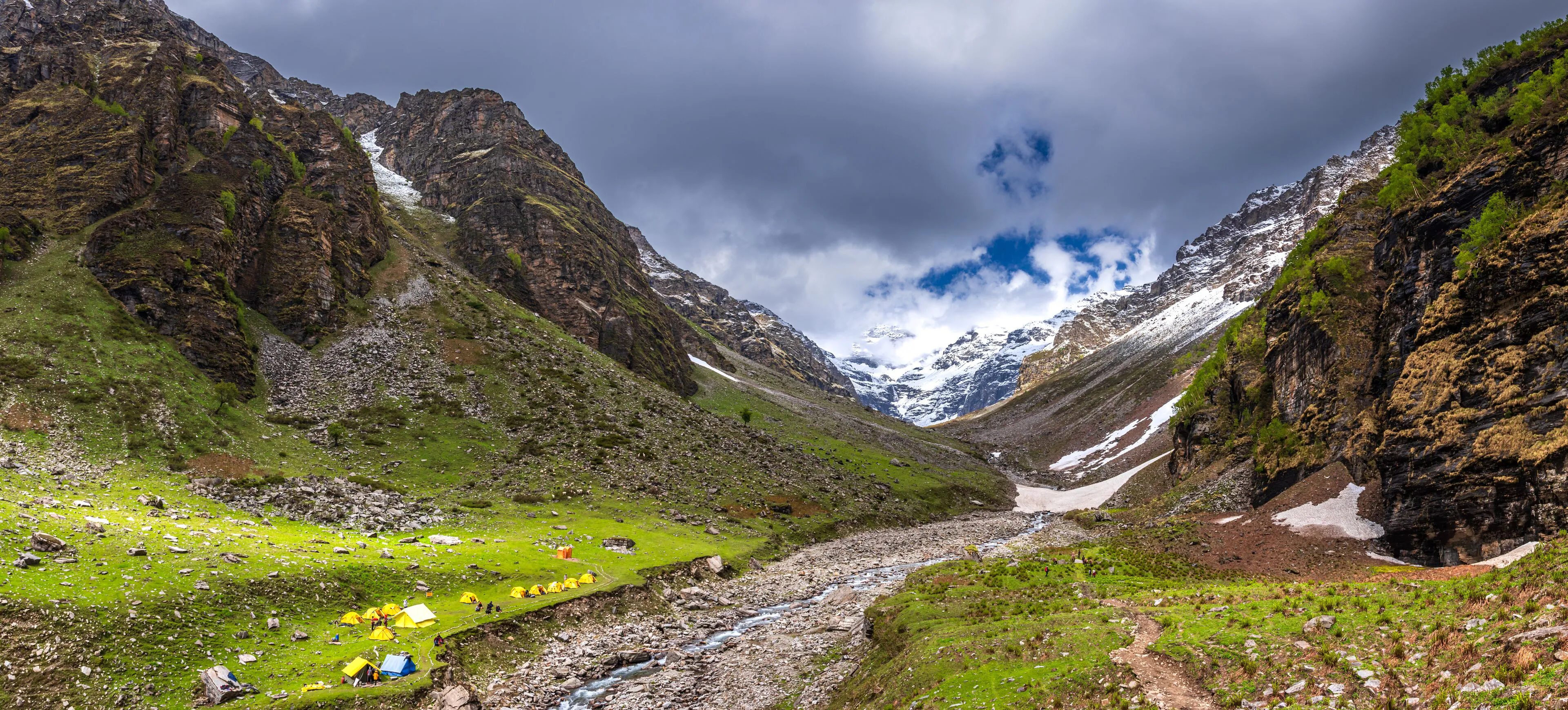
The approach to the Baspa Valley runs along one of the most spectacular roads in India. NH-5 from Shimla follows the Sutlej River through progressively wilder country: after Rampur Bushahr the gorge tightens, the cliffs steepen, and the road begins its cliff-cut drama through the sections known as the suicide stretches — not because they are necessarily fatal, but because the drop below the outer edge is of the kind that commands absolute attention. This is a road to be driven slowly, with both hands on the wheel and no music. At Karcham, 18 kilometres before Sangla, you turn right off NH-5 across the Karcham bridge and immediately enter a different geological and cultural world.
A critical update for 2026: the Border Roads Organisation began construction on the 40-kilometre Karcham–Sangla–Chitkul road section in 2024, widening and metalling a route that has long been a single-lane affair through some technically demanding mountain terrain. This work is ongoing through 2025–2026. In practical terms, expect construction delays — blown dust, unmetalled diversions, waiting at single-lane sections while machinery passes, and the general productive inconvenience that accompanies a road being improved. The result will be significantly better access in future years. For now, allow extra time, go in the morning when machinery is less active, and check locally at Karcham or Sangla for the day's road status before heading to Chitkul.
The most comfortable public transport option is the HRTC bus from Shimla ISBT, departing at 6:50 AM, which reaches Sangla by mid-afternoon. From Sangla, local shared jeeps to Chitkul run a few times daily, taking about an hour; a private taxi costs ₹800–1,200. The three HRTC buses from Chitkul — at 6:30 AM, 1:30 PM, and 4:00 PM — are the lifeline for villagers and provide the best honest view of how the valley moves. The 1:30 PM service continues to Reckong Peo, making it useful for those continuing to Kalpa or onward to Spiti.
| ROUTE | FROM | DISTANCE | TIME | NOTES |
|---|---|---|---|---|
|
Delhi → Chandigarh → Shimla → Narkanda → Rampur → Karcham → Sangla |
Delhi |
~575 km |
12–14 hrs |
Best overall route; HRTC overnight buses to Shimla; change to Reckong Peo service from Shimla; NH-5 along Sutlej Gorge is dramatic and reliable |
|
Shimla to Sangla (direct HRTC bus) |
Shimla ISBT (Tutikandi) |
~185 km |
7–8 hrs |
One daily direct departure at 6:50 AM; reaches Narkanda ~10 AM, Sangla by afternoon; ₹300–450 fare |
|
Shimla to Reckong Peo bus + taxi to Sangla |
Shimla |
~215 km total |
8–10 hrs |
More frequent buses to Reckong Peo (₹400–600); taxi/shared cab Peo–Sangla: ₹400–800 |
|
Karcham to Sangla (the valley turnoff) |
Karcham junction on NH-5 |
18 km |
30–40 min |
Right turn at Karcham over the bridge into Baspa Valley; dramatic gorge narrows immediately |
|
Sangla to Rakcham |
Sangla |
~13 km |
25–30 min |
Good road with Baspa on right; apple orchards all along |
|
Rakcham to Chitkul |
Rakcham |
~15 km |
30–40 min |
Road quality mixed; BRO construction active; river views exceptional |
|
Sangla to Chitkul (full drive) |
Sangla |
28 km |
1–1.5 hrs |
Single lane in sections; allow 1.5 hrs for comfort and photo stops at Rakcham viewpoint |
|
Chitkul bus (HRTC from Chitkul) |
Chitkul |
— |
— |
Departures: 6:30 AM, 1:30 PM, 4:00 PM; 1:30 PM continues to Reckong Peo; verify locally |
ROUTES AND TRANSPORT
When to go...
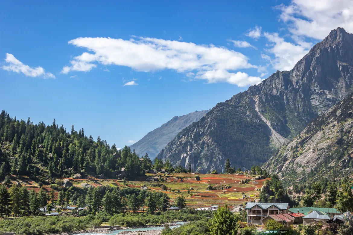
The Baspa Valley has a more forgiving monsoon than most of Himachal Pradesh. The valley sits in a partial rain shadow — much of the moisture coming from the southwest monsoon is blocked by the Zanskar and Greater Himalayan ranges to the south, and the rainfall in Kinnaur between July and September is considerably lower than in Kullu or Manali. This does not mean the road is without risk in the monsoon; the Karcham–Sangla section is an active geological zone and landslides do occur, particularly in late July and early August. But many years, the valley is accessible and genuinely beautiful throughout the monsoon months, when the lower slopes turn emerald green, the Baspa runs full and fast, and the apple orchards begin their slow progression from blossom to fruit.
The two finest months are May and September. May offers the year's freshest air — the valley has just reopened after winter, the apple blossom is still on the trees, the snow on Kinner Kailash is at its most dramatic white against a clear blue sky, and the only people in the valley are those who have planned specifically for it. September brings the apple harvest — the Kinnauri apple, developed from rootstock that arrived with European horticulturalists in the late 19th century, is one of the great agricultural achievements of the Himalaya, and in September the orchards hang heavy with fruit of a quality and flavour that will make every subsequent supermarket apple feel like a reasonable approximation of the thing rather than the thing itself. The harvest is a community event; the valley smells of fruit and cold air; the light is amber; the crowds have thinned. It is, by a comfortable margin, the best time to be here.
| MONTH | CONDITIONS | WHAT'S OPEN | NOTES |
|---|---|---|---|
|
March–April |
Cold, snow melting; roads open early April |
Sangla accessible; Chitkul road may have snow patches |
Quiet, beautiful early season; carry winter gear; some guesthouses closed |
|
May |
Warming up; valley green; apple blossom |
Full valley including Chitkul; most guesthouses open |
Excellent uncrowded window; fresh snow on Kinner Kailash spectacular |
|
June |
Pleasant 18–22°C in Sangla; 10–14°C Chitkul |
All sites, treks, guesthouses fully open |
Weekends busy; best for Borasu Pass prep; Sangla Holi (March) already passed |
|
July |
Warm; occasional rain in lower sections |
Full access; minor road disruptions possible near Karcham |
Pre-monsoon showers; Kinnaur less affected than Kasol/Kullu; still manageable |
|
August |
Most stable month in Baspa Valley (rain shadow) |
All sites open; Borasu Pass best in August |
Excellent for photography: lush green valley, snow peaks above; fewer landslides than Parvati |
|
September |
Golden light; autumn colours begin; crisp |
All sites open; Borasu Pass closes mid-September |
Peak photography month; apple harvest begins; highly recommended |
|
October |
Apple harvest in full swing; cold nights |
Chitkul accessible early October; may close mid-Oct |
Brilliant autumn colours; last reliable month; Kinner Kailash Parikrama ends |
|
November–April |
Deep winter; heavy snowfall; road closed |
Sangla may be accessible; Chitkul closed |
Winter specialists only; Karcham–Sangla road typically closes late November |
MONTH-BY-MONTH SEASON GUIDE
THE KINNAURI APPLE IN SEPTEMBER TASTES LIKE WHAT A MARS BAR WOULD TASTE IF IT WERE MADE BY SOMEONE WHO HAD ONLY EVER SEEN THE HIMALAYAS AND A COLD RIVER AND HAD NEVER ENCOUNTERED SUGAR AT ALL — TART, COMPLEX, WITH A FINISH THAT IS PURE MOUNTAIN AIR. NO SUPERMARKET APPLE HAS EVER TASTED LIKE THIS, AND NONE EVER WILL.
Things to do in Sangla and Chitkul...
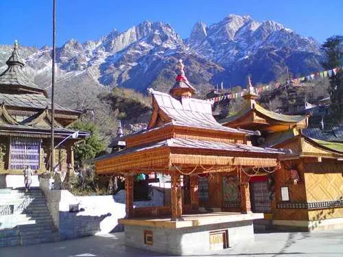
Kamru Fort and the Kamakhya Devi — the five-storey fort at Kamru village, 800 metres uphill from Sangla town on a paved path through traditional stone-and-wood houses, is one of the most significant and least-visited heritage sites in Himachal Pradesh. Built in the traditional Kath Kuni style — alternating courses of stone bound with wooden rafters, surmounted by a carved wooden superstructure with a gabled ridgepole roof — it served as the seat of the Bushahr kingdom and the site of every Bushahr king's coronation ceremony. The fort is now a functioning temple complex housing, by local count, all 33 crore devatas of Hinduism within its walls. The presiding deity is the Kamakhya Devi — the same goddess worshipped at the great Kamakhya Temple in Guwahati, whose idol was, according to tradition, carried across the entire subcontinent to reside here. To enter the inner sanctum you must don a Kinnauri topi (the distinctive green-edged woollen cap of Kinnaur) and a kamarbandh (a woven waist belt) — both available to borrow at the gate for a nominal charge — and leave all leather items outside: shoes, belts, and wallets without exception. The fort's carved wooden balconies overlook the entire Baspa Valley and the Kinner Kailash massif behind it, and there is a small Badrinath temple within the complex dating to the 15th century. Allow 90 minutes. Go in the morning.
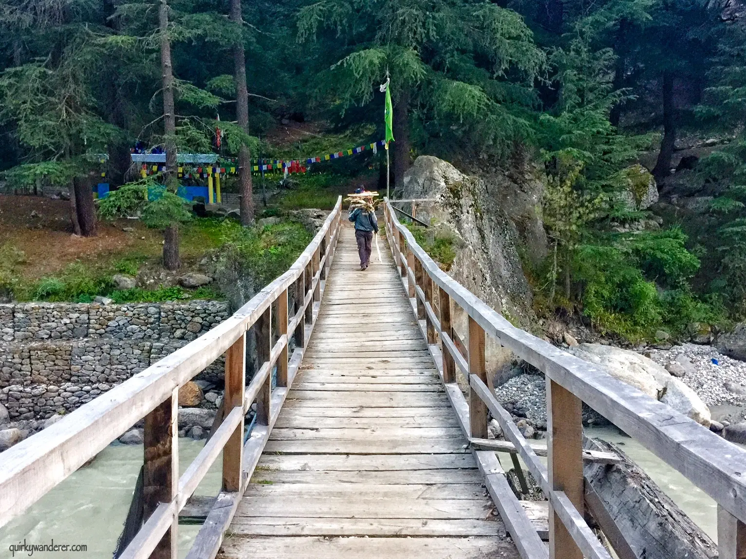
The Baspa riverside walk, Batseri to Sangla — the most underrated walk in the valley is the four-kilometre trail along the Baspa River between Batseri village and Sangla town. Batseri, which sits slightly lower in the valley between the two, has its own extraordinary wooden temple — the Bering Nag Devta complex — and a cluster of traditional houses whose carved wooden facades are among the finest examples of Kinnauri domestic architecture you will find at road level. Toshim Homestay, run by Vikrant and his sisters and awarded more five-star reviews than any property in the valley (one reviewer wrote that if there were a way to give more than five stars, Toshim would quietly collect them all and still act humble about it), is here in Batseri. The riverside walk between Batseri and Sangla follows the Baspa's bank through apple orchards and patches of deodar pine, with the river audible and occasionally visible below. Do it in the afternoon light.
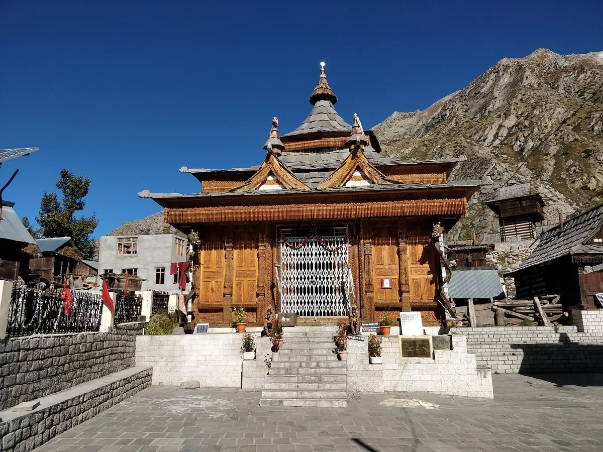
Chitkul village and the Mathi Devi Temple — Chitkul's central spiritual focus is the Mathi Devi Temple, believed to be around 500 years old, whose multi-tiered pagoda roof in the classic Kinnauri style stands at the village centre against the backdrop of the snow peaks at the valley head. The temple's inner sanctum is closed to visitors — as is the case with most active Kinnauri temples where the deity is present — but the outer courtyard and the carved wooden entrance panels are freely accessible and warrant serious attention. The village itself, of fewer than 600 residents, consists of traditional Kath Kuni houses, a small market of three or four shops selling Maggi, chai, and basic provisions, and the specific quality of late-afternoon light on wooden houses that makes photographers lose all track of time. Walk to the last house in the village. Stand at the sign at the road's end. Look at the path that disappears around the mountain.
The walk to Nagasti ITBP post — two kilometres beyond Chitkul village, across the bridge below the settlement and along the Baspa's bank, is the Nagasti Indo-Tibetan Border Police post — the first military station on the route that continues, restricted to civilian access, toward Tibet. The walk takes 45 minutes one way on a clear track through open alpine terrain, and it is one of the more emotionally particular walks you can take in India: you are walking toward a boundary that is both physical and conceptual, approaching the point at which the country you are in becomes defined by what it is not. The ITBP personnel are generally courteous; the post is the formal boundary; do not attempt to proceed beyond it. The view back toward Chitkul from the path near Nagasti — the village, the temple roof, the river, the peaks above — is one of the valley's finest.
Kinner Kailash from Sangla — the mountain as presence — you do not need to trek to the Shivlingam to have a genuine relationship with Kinner Kailash. The back face of the massif — different from the frontal view available from Kalpa — is visible from Kamru Fort and from the Sangla Buddhist Monastery on the hillside above town, and in the early morning when the air is clear and the peak is lit from the east, the scale of what you are looking at becomes apparent in a way that photographs never quite capture. The Shivlingam that Kinnauris believe changes colour through the day is visible on the massif's face as a dark vertical feature; whether you experience it as geology or as deity is, in this valley, largely a question of how long you have been here. Most visitors report that the longer they stay, the harder the distinction becomes to maintain.
Apple orchard season and chilgoza pine nuts — the Kinnauri apple deserves a dedicated paragraph because it is genuinely one of the finest agricultural products in India and almost unknown outside the valley and the premium fruit markets of Delhi and Mumbai. The rootstock for the Kinnauri apple was introduced by horticulturalists during the British period to the same high-altitude, cold-climate conditions that produce the great apples of Normandy and the Tyrol, and the result is a fruit of exceptional complexity. In September, when the harvest is at its peak, entire roadsides are lined with sorting stations where families grade apples by size and colour for dispatch. Buy directly from an orchard; the price is minimal and the experience of eating a Kinnauri apple off the tree, at altitude, in the valley where it was grown, is incomparable. The chilgoza — the pine nut from the chilgoza pine forests of Kinnaur — is the valley's other great food product: expensive, intensely flavoured, and a genuine souvenir worth carrying home.
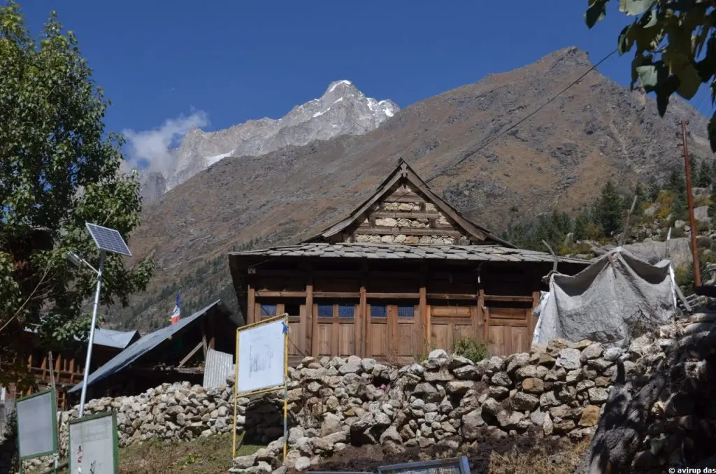
Rakcham — the midpoint worth stopping for — the village of Rakcham, midway between Sangla and Chitkul, is consistently skipped by travellers in a hurry to reach the last village. This is an error. Rakcham sits at a point where the valley narrows dramatically, the river appears below a high rock spur, and the road — such as it is — passes through a spectacular natural defile that is among the most striking sections of the entire Baspa corridor. Hotel Kinnor Retreat here is one of the best mid-valley accommodation options; the bonfires in the courtyard on cold evenings are the warmest things in a ten-kilometre radius. Rakcham also serves as the trailhead for the Lamang Thach route — a less-frequented alpine meadow above the village reached in 3–4 hours of uphill walking.
| ACTIVITY / TREK | FROM | DISTANCE / TIME | DIFFICULTY | BEST SEASON | NOTES |
|---|---|---|---|---|---|
|
Sangla to Kamru Fort walk |
Sangla town |
800m uphill / 20–30 min |
Easy (paved steps) |
May–Oct |
Wear Kinnauri topi & kamarbandh (belt) at gate — provided; leave all leather outside; stunning valley views from top |
|
Sangla to Batseri riverside walk |
Sangla |
3–4 km / 1 hr |
Easy |
May–Oct |
Apple orchards along Baspa riverside; traditional wooden houses in Batseri; Toshim Homestay here |
|
Rakcham to Chitkul riverside trail |
Rakcham |
8–10 km / 3–4 hrs |
Easy–Moderate |
June–September |
Alternative to road; follows Baspa's left bank; mild elevation changes; wildflowers in July–August |
|
Chitkul to Nagasti ITBP post walk |
Chitkul |
~2 km / 45–60 min one way |
Easy |
June–Sept |
Last civilian-accessible point; across Baspa bridge below Chitkul, then trail; ITBP post marks the boundary — do not proceed beyond |
|
Ranikanda Meadows (day hike) |
Chitkul |
~10 km from Chitkul / 4–5 hrs |
Moderate |
July–Sept |
High-altitude meadow above Chitkul; first campsite of Lamkhaga Pass trek; permission from local authorities required to pass Nagasti ITBP post |
|
Sangla Meadows (local walk) |
Sangla |
2–3 km / 1–2 hrs |
Easy |
May–Oct |
Pastoral meadows above town; views of Kinner Kailash; shepherd paths; ideal for mornings |
|
Borasu Pass Trek |
Sankri (Uttarakhand) ending at Chitkul |
~90 km / 8 days |
Difficult |
July–mid-September |
Crosses from Har Ki Dun (Uttarakhand) to Baspa Valley; peaks at 5,450m; ice axe and crampons required; registered operator essential; one of India's finest trans-Himalayan crossings |
|
Kinner Kailash Parikrama (pilgrimage) |
Tangling village (near Kalpa) |
~60 km circuit / 3–5 days |
Difficult / pilgrimage |
July–mid-September |
One of five sacred Shiva Kailash pilgrimages; Shivlingam changes colour dawn to dusk; revered by both Hindu and Buddhist Kinnauris; local guide essential |
ACTIVITIES AND TREKS — BASPA VALLEY 2026
KINNER KAILASH DOES NOT REQUIRE YOU TO TREK TO IT OR BELIEVE IN IT. IT REQUIRES ONLY THAT YOU LOOK AT IT LONG ENOUGH — AND THE MOUNTAIN DOES THE REST. THE KINNAURIS HAVE KNOWN THIS FOR CENTURIES. THE MOUNTAIN CHANGES COLOUR BECAUSE IT IS A DEITY. THE GEOLOGISTS HAVE A DIFFERENT EXPLANATION. BOTH ARE TRUE.
Things not to do in Sangla and Chitkul...
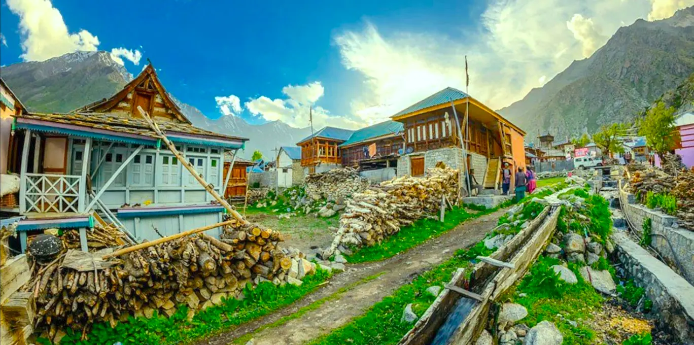
Do not attempt Kamru Fort without the proper dress — the dress code at Kamru Fort is not a tourist formality. The Kinnauri topi and kamarbandh worn inside the complex are the same garments worn by the Bushahr kings at their coronation; they are the appropriate dress for entering a space that local belief holds to contain every deity in the Hindu pantheon simultaneously. The rule about leather is equally earnest: shoes, belts, leather wallets, leather watch straps — all must be left outside. The caretakers at the gate are courteous but firm; treating the requirement as a bureaucratic inconvenience rather than a genuine cultural observance is immediately visible and not welcomed. Topi and kamarbandh are available to borrow at the gate for a nominal charge. Accept them gratefully and put them on properly.
Do not try to cross the boundary beyond Chitkul — the sign at the road's end in Chitkul is unambiguous and must be taken seriously. Civilian movement beyond the village is prohibited without specific military/administrative clearance, which is not routinely granted. The ITBP post at Nagasti is two kilometres away and accessible on foot; proceeding beyond the post is a different matter entirely. This is an active border zone. Border violations result in detention and potential legal proceedings. The military personnel at Nagasti are not tourist facilitators; treat the boundary with complete respect.
Do not plan the drive to Chitkul as an afternoon trip from Shimla — Sangla is 185 kilometres from Shimla on roads that require consistent concentration. Chitkul is 28 kilometres beyond Sangla, with construction zones active in 2026. The idea of arriving in Shimla by midday and reaching Chitkul in time for a sunset photograph is almost certainly wrong: it leaves no margin for road delays, construction traffic, the sheer entertainment value of the Sutlej Gorge, or the correct pace of travel in a valley this beautiful. Build in two nights minimum: one in Sangla (for Kamru Fort, the riverside walk, and the market), one in Rakcham or Chitkul (for the road's end and the morning light on the peaks). The valley does not reward haste.
Do not underestimate the cold at Chitkul — Chitkul is at 3,450 metres. Even in July, temperatures drop to 5–8°C after dark. In May and October, they can reach 0°C or below. The guesthouses at Chitkul are basic; hot water is not guaranteed; heating is minimal. A good down jacket, thermal base layers, and a warm sleeping bag (if camping) are not optional. The specific cold of Chitkul — thin air, no wind-breaking topography, cold river nearby — is more penetrating than the thermometer suggests. The number of visitors who arrive in summer clothes and leave shivering on the first evening is, by all accounts, considerable.
Do not buy apples or chilgoza at the first shop you pass — this sounds like minor advice but it is genuinely useful. The apple sorting stations along the road between Rakcham and Chitkul grade fruit in real time; the ones that don't make the export grade are sold locally at prices that are lower and quality that is, paradoxically, often higher — because the grading is for appearance rather than flavour. Ask at your homestay where to buy directly from the orchard. Similarly, chilgoza pine nuts are sold at significant price variation between the valley and Shimla or Delhi; buy here and buy in volume if you can carry it.
Do not skip Rakcham on the way to Chitkul — this is perhaps the most practically costly mistake in the valley, because the consequence is not merely missing a beautiful village but arriving at Chitkul in the blunt midday light rather than the golden afternoon. Leave Sangla early, stop at Rakcham for an hour (the viewpoint above the village of the valley confluence, the tea stalls, the narrow gorge section of the road), and arrive in Chitkul with enough light for the evening walk to Nagasti and back. Time of arrival at Chitkul matters significantly for the quality of what you experience there.
| REQUIREMENT | WHO | COST | WHERE / NOTES |
|---|---|---|---|
|
Valid photo ID (Aadhaar / Passport) |
All travellers |
— |
Police checkpost at Karcham bridge checks ID; mandatory |
|
Protected Area Permit (PAP) |
Foreign nationals only (for travel beyond Karcham into Kinnaur) |
₹250–400 approx |
SDM Office Reckong Peo or Shimla / Chandigarh offices; online application possible; allow 2–3 days |
|
Kamru Fort entry (Kinnauri topi + kamarbandh) |
All visitors to the temple complex |
Nominal (topi/belt hire charge at gate) |
Both items available to hire at the fort gate; leather shoes, belts, wallets must be left outside |
|
Chitkul village photography |
All visitors |
— |
Respectful photography of landscape and architecture freely permitted; seek permission before photographing villagers or interior of temples |
|
Nagasti ITBP post access (beyond Chitkul) |
Any civilian |
Special permission required |
Apply locally through SDM/DM office; not routinely granted; treat Chitkul village as journey end |
|
Ranikanda Meadows (beyond Nagasti) |
All trekkers |
Permission from local authorities |
Coordinate through registered trek operator or SDM Reckong Peo |
|
Borasu Pass Trek permit |
All trekkers |
Included in operator fee (verify) |
Registered operator handles Forest Dept and ITBP clearances; do not attempt independently |
PERMITS AND PRACTICAL NOTES — 2026
Where to stay...
Toshim Homestay in Batseri village — halfway between Sangla town and Rakcham — is the most consistently praised property in the valley and arguably one of the most reviewed homestays in all of Kinnaur. Run by Vikrant and his sisters, it has earned the kind of loyalty that makes repeat visitors who have seen dozens of Himalayan guesthouses say flatly that it is the best homestay they have ever encountered. The food is home-cooked; the rooms are clean and well-maintained with balcony views of the Baspa; the hospitality is of the sort that a sensible travel writer describes without hyperbole and lets stand on its own. Book ahead in peak season: it fills quickly and rightly so.
In Sangla itself, Zostel offers the reliable hostel infrastructure that young solos and budget travellers expect, with social common areas and consistent standards. At the premium end, Banjara Camp and Retreat offers what amounts to the valley's most considered luxury experience — private tented accommodation in an apple orchard setting with full board and a hospitality team that understands what people who have been driving mountain roads all day actually need. At the midpoint of the valley, Hotel Kinnor Retreat in Rakcham is the strongest mid-range option, with a firelit atmosphere and mountain views that make it an excellent base for a two-night Baspa Valley itinerary.
In Chitkul, accommodation is honest and basic. The guesthouses — RR Homestay and several unnamed village operations — offer clean rooms and local food at very modest prices. Hot water is solar-heated and weather-dependent; power from the generator cuts at 10pm; the night sky, once the lights are off, is extraordinary. For those willing to sleep at 3,450 metres in a simple room with a wool blanket and the sound of the Baspa below, Chitkul overnight is one of the more clarifying experiences the Himalayas offer.
| PROPERTY | LOCATION | TYPE | PRICE RANGE | NOTES |
|---|---|---|---|---|
|
Toshim Homestay |
Batseri village, between Sangla and Chitkul |
Homestay |
₹1,500–2,500/room (B&B) |
The most consistently praised property in the valley by a considerable margin; run by Vikrant and sisters; home-cooked meals; balcony with Baspa views; heated blankets |
|
Banjara Camp and Retreat Sangla |
Sangla valley |
Luxury tented camp |
₹8,000–14,000/night |
Premium option; private tents in apple orchard setting; full board; book ahead |
|
Zostel Sangla |
Sangla main area |
Hostel |
Dorm: ₹400–600 / Private: ₹1,200–2,000 |
Social hostel; reliable infrastructure; good for solos and couples |
|
Hotel Kinnor Retreat |
Rakcham village |
Hotel / Guesthouse |
₹1,500–3,000/room |
One of the best mid-valley positions; bonfire evenings; helpful staff; mountain views |
|
Kailash View Camp Rakcham |
Rakcham |
Tented camp |
₹1,200–2,500/tent |
Riverside camp; Kinner Kailash backdrop; ideal for photographers |
|
RR Homestay Chitkul |
Chitkul village |
Homestay |
₹800–1,500/room |
Budget option right in the last village; basic but clean; home meals; book ahead in peak season |
|
Hotel Apple Orchid / local guesthouses |
Chitkul |
Guesthouses |
₹700–1,500/room |
Several options in Chitkul; quality varies; river and meadow-facing rooms preferred; check hot water availability |
|
NotOnMap — Adobe the Cloud |
Near Sangla |
Boutique homestay |
₹2,500–4,000/room |
Much-praised boutique experience with exceptional views and thoughtful design; book well ahead |
WHERE TO STAY — BASPA VALLEY ACCOMMODATION
Travelling responsibly in the Baspa Valley...
The Kath Kuni architecture of the Baspa Valley — the interlocking wood-and-stone construction that has kept houses standing through Himalayan winters for hundreds of years — is under quiet threat from a combination of economic pragmatism and the availability of corrugated tin sheets. New construction in Chitkul and Sangla increasingly uses tin and concrete rather than traditional materials; the ITBP barracks and the new high school have both used tin roofing rather than the slate that gives traditional buildings their character. Spending money at homestays in Kath Kuni properties, commenting positively on traditional architecture, and avoiding the concrete-and-tile guesthouses that are easier to build and maintain is a small but genuine contribution to the economic case for keeping the traditional building tradition alive.
The Baspa River is clean, cold, and largely uncontaminated above Sangla. A LifeStraw bottle or quality filter eliminates any need for plastic water bottles, which are appearing with increasing frequency in roadside ditches as tourism volumes grow. Take your waste out; there is no municipal collection system in Chitkul, and the visual impact of plastic packaging on a landscape this austere is disproportionately severe.
The cultural etiquette of Kinnaur has one rule that overrides all others: ask before you assume. The Kinnauris are among the most hospitable mountain communities in India, but their hospitality has limits, and those limits are most clearly defined around their temples and their domestic spaces. The rule at Kamru Fort is the most specific — Kinnauri topi, kamarbandh, no leather — but it reflects a general principle: that this is a valley with its own sacred geography, its own relationship with its mountain, and its own right to determine the terms on which it receives visitors. Photography of the inner temple sanctum is generally not permitted anywhere in the valley. Asking for permission before photographing villagers is not merely polite — it is correct.
Before you go — a few honest additions...
Four days is the right minimum for Sangla and Chitkul: a day arriving via the Sutlej Gorge with the appropriate level of attention to what you are driving through, a day for Sangla and Kamru Fort and the Batseri walk, a day for the drive to Chitkul with the Rakcham stop and the evening walk to Nagasti, and a day to retrace or continue onward to Kalpa and Reckong Peo. Six days allows the addition of the Kinner Kailash views from Kalpa, the Sangla Meadows morning walk, and a proper apple-buying expedition before you leave. Ten days, combined with the extension to the Kinner Kailash Parikrama or the beginning of the Borasu Pass trek, is the full and proper encounter with this corner of Himachal Pradesh that the landscape deserves.
The BRO road construction on the Karcham–Chitkul section is the single most significant practical consideration for 2026 travel. The work will produce a much better road; in the short term, it produces delays, dust, and sections of genuinely bad surface. Early morning travel minimises construction traffic. Asking locally at Sangla before heading to Chitkul about the day's conditions is worthwhile and takes five minutes. This is a valley where five minutes of local intelligence is worth an hour of internet research.
The team at BizareXpedition™ Services Pvt. Ltd. (bizarexpedition.com), based in Haridwar and specialising in Himalayan journeys, can design a fully customised Kinnaur itinerary that builds the Baspa Valley into a broader Himachal or trans-Himalayan journey — linking Sangla and Chitkul with Kalpa's views of the sacred peak, the monastery circuit of Spiti beyond, or the pilgrimage trails of Uttarakhand to the south. The valley rewards those who arrive knowing something of what they are looking at, and BizareXpedition brings that contextual depth to every itinerary they plan.
| TEM | NOTES |
|---|---|
|
Cash |
Last ATM: Reckong Peo (35 km from Sangla) — withdraw generously; Sangla has one ATM but it frequently runs dry |
|
Fuel |
Fill up at Reckong Peo or Karcham — Sangla has a pump but may be rationed in peak season; no fuel in Chitkul |
|
Mobile network |
BSNL works best through Kinnaur; Airtel partial in Sangla; Jio largely absent; no signal in Chitkul |
|
LifeStraw / water filter |
Baspa River water is glacial and clean; filter for drinking; avoid buying plastic bottles in the valley |
|
Warm layers |
Chitkul drops below 5°C most evenings even in July; carry down jacket, thermal base, wind shell |
|
Vehicle |
High clearance recommended for Sangla–Chitkul road; sedan manageable but not ideal given BRO construction zones |
|
Road status check |
BRO construction on Karcham–Chitkul 40km section active in 2025–2026; check locally for delays or closures |
|
Kamru Fort dress code |
Kinnauri topi (cap) and kamarbandh (belt) mandatory inside the complex — provided at gate; ALL leather items left outside |
|
Photography etiquette |
Kath Kuni wooden houses, temples, and valley landscapes freely photographable; always ask before photographing villagers; no photography inside inner temple sanctum |
|
Emergency contact |
Reckong Peo Police: 01786-222201; District Hospital Reckong Peo: 01786-222008; Karcham HRTC: contact locally |
PRACTICAL CHECKLIST
| CATEGORY | BUDGET (₹/DAY) | BUDGET (₹/DAY) MID-RANGE (₹/DAY) | PREMIUM (₹/DAY) |
|---|---|---|---|
|
Accommodation |
700–1,200 (basic guesthouse/village homestay) |
1,500–2,500 (Toshim-tier / Hotel Kinnor) |
3,000–10,000+ (Banjara Camp / boutique) |
|
Food |
300–500 (daal-chawal, Maggi, home meals at homestay) |
600–900 (full board at homestay; local restaurant in Sangla) |
1,000–1,500 (resort full board) |
|
Local transport |
100–200 (HRTC bus Sangla–Chitkul ₹60–80) |
500–800 (shared taxi/jeep) |
1,500–2,500 (private jeep, full-day) |
|
Trek guide (if needed) |
— |
₹800–1,500/day (local Sangla/Chitkul guide) |
Full operator package: ₹5,000–12,000/day all-in (Borasu etc.) |
|
Total per day estimate |
₹1,200–2,000 |
₹3,000–5,000 |
₹6,000–15,000+ |
BUDGET GUIDE — PER PERSON PER DAY
There is a moment that happens reliably on the road back from Chitkul, somewhere around Rakcham, when the valley widens again and the light is on the apple orchards and you can see Sangla below and you understand that what you have just visited was not a tourist destination or a scenic viewpoint or a place on a list. It was the end of a road in a country, in a valley that has been here since before the road existed, watched over by a mountain that changes colour through the day and does not require your belief in order to do so. The belief, you realise, arrived somewhere along the way without you noticing. That is what Kinnaur does.