

Abhishek
Writer
Updated On - Aug 12, 2026
15 min
Published On - May 25, 2026
Tourist Mistakes in Spiti Valley — And How Not to Make Them
Many travelers make avoidable mistakes while visiting Spiti Valley, from ignoring altitude sickness to poor road-trip planning. Knowing the region’s weather, road conditions, and local customs can make your journey safer and more enjoyable. Follow these simple tips to experience the beauty of Spiti Valley without unnecessary trouble.
I'll be honest with you — I didn't fully understand what I was getting into the first time I headed to Spiti. I'd done Manali. I'd done Ladakh. How different could it be? The answer, it turns out, is very. Spiti Valley sits at an average of 3,800 metres in Himachal Pradesh's cold desert, squeezed between the Great Himalayan Range and the Tibetan Plateau. Roads open for maybe five, six months a year if you're lucky. The rest of the time, it's buried under snow that would make a Scandinavian shrug.
There's a lot here — monasteries that have been standing for a thousand years, villages at altitudes that make Everest base camp look casual, and a landscape so stripped back and raw that the mountains literally change colour every half hour as the light shifts. Buddhist heritage, serious trekking, scenery with zero Indian equivalent. It's all there. So is altitude sickness, so are washed-out roads, so are nights so cold you'll lie awake wondering who told you a light fleece would be fine.
The Lahaul and Spiti district has about 31,500 permanent residents across nearly 14,000 square kilometres. One of the least densely populated districts in the country. Then summer hits and tourists flood in — and the valley's infrastructure, which was never built for this volume, quietly buckles. The same mistakes get made, in roughly the same sequence, every single year. Here's what they are.
Rushing the Altitude
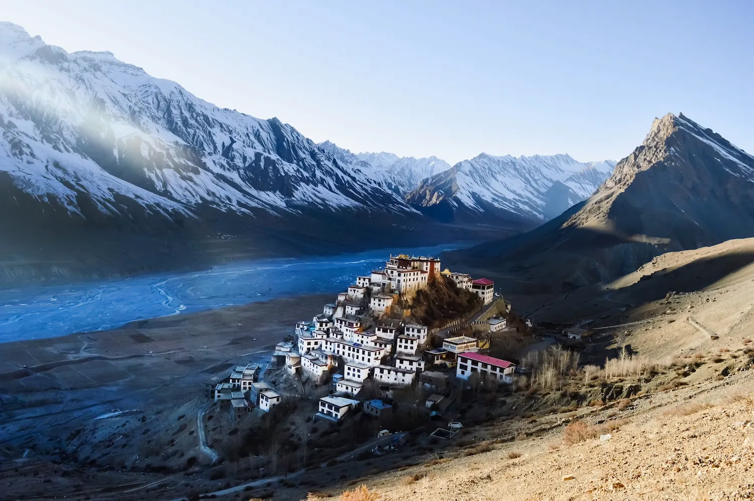
This one gets people every time, and it gets them fast. The typical move: fly into Chandigarh, two days of driving via the Manali route, arrive in Kaza wondering why your head feels like someone's slowly tightening a clamp around it. Kaza is at 3,800 metres. Kibber, just up the road, is at 4,270 metres — above Annapurna Base Camp in Nepal. Komic village, with maybe ten to fifteen families and a 14th-century monastery, sits at 4,587 metres. People look at those numbers and nod, and then proceed to ignore them entirely.
Acute Mountain Sickness doesn't care about your fitness level. It doesn't care that you ran a half marathon last month or spent a week in Leh three years ago. Studies in Spiti Valley found AMS rates of 28.7% among permanent residents living between 3,000 and 4,200 metres — people who live there. For visitors coming up fast from lower altitudes, the numbers are worse. Symptoms show up six to twelve hours in: headache, nausea, breathlessness, that heavy-limbed fatigue that makes you want to lie completely still. If it gets worse instead of better after rest, you descend. That's the only answer.
| Location | Altitude (m) | Altitude (ft) | Global Benchmark |
|---|---|---|---|
|
Tabo Monastery |
3,050 m |
10,010 ft |
Above most European ski resorts |
|
Kaza — administrative capital |
3,800 m |
12,467 ft |
Higher than Mont Blanc base |
|
Dhankar Monastery |
3,894 m |
12,776 ft |
Annapurna Circuit midpoint |
|
Key Monastery (Ki Gompa) |
4,166 m |
13,668 ft |
Above most EBC acclimatisation stops |
|
Kibber village |
4,270 m |
14,009 ft |
Above Annapurna Base Camp (4,130 m) |
|
Chandratal Lake |
4,300 m |
14,107 ft |
Above Thorong La base camp, Nepal |
|
Hikkim — world's highest post office |
4,400 m |
14,436 ft |
Above Langtang Valley, Nepal |
|
Komic — highest motorable village in the world |
4,587 m |
15,049 ft |
457m higher than Annapurna Base Camp |
|
Kunzum Pass — gateway on Manali route |
4,590 m |
15,059 ft |
Among the highest paved passes in India |
Table 1 — Spiti Valley Altitude Reference
If you're coming in via the Shimla–Reckong Peo–Nako route, you've got a natural acclimatisation ladder built into the drive. Use it. Spend a night in Nako at 3,625 metres before pushing to Kaza. If you're coming via Manali and Kunzum, stop at Chandratal or Batal — don't just roll straight through because you're keen. Three to four litres of water a day. No alcohol for the first 48 hours. The table below puts the risk in plain numbers.
| Statistic | Figure | Source |
|---|---|---|
|
AMS prevalence among Spiti permanent residents (3,000–4,200m) |
28.7% |
Indian Journal of Medical Research / IGMC Shimla |
|
Moderate to severe AMS among Spiti residents |
4.9% |
PubMed — Epidemiological Study of CMS, Spiti Valley |
|
Oxygen reduction at 3,800m vs sea level |
~40% lower |
WHO / Wilderness Medicine Society |
|
Average blood SpO2 of Spiti residents at altitude |
89.3% (vs 98% at sea level) |
NCBI / PMC Himalayan altitude study |
|
Time for symptoms to appear after rapid ascent |
Within 6–12 hours |
Wilderness Medical Society Guidelines |
|
Minimum acclimatisation stop recommended |
1 night at 3,000–3,500m before going higher |
Himalayan Rescue Association / BMA |
|
Recommended daily water intake at 3,800m+ |
3 to 4 litres |
Wilderness Medical Society |
|
AMS risk via rapid Manali–Kaza ascent (2 days) |
High — no acclimatisation buffer built in |
Spiti Valley travel medicine consensus |
|
AMS risk via Shimla–Kaza ascent (3–4 days) |
Substantially lower — gradual elevation gain |
Himalayan Rescue Association |
Table 2 — Acute Mountain Sickness: Key Statistics for Spiti Visitors
Underestimating the Roads
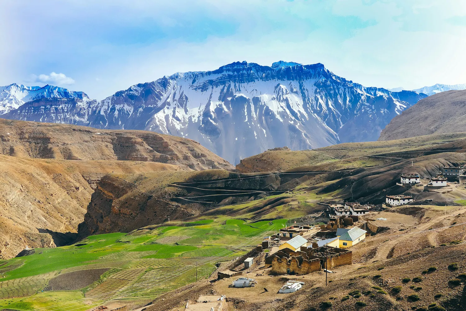
Spiti's roads are the stuff of legend — and not the flattering kind. The Manali route crosses Rohtang at 3,978 metres and Kunzum at 4,590 metres, and the stretch between Gramphoo and Kaza is essentially a live negotiation between the road and the mountain. Loose gravel. River crossings. Sections that vanish after rain. Places where the road and the riverbed are the same thing and you just have to commit. A 60-kilometre section can swallow three to four hours on a bad day. The Shimla route via Kinnaur and Nako is more forgiving — stays open most of the year — but at 412 kilometres to Kaza, it's not something you rip through either.
The mistake I see constantly is people treating this like a normal road trip. "We'll cover 200 kilometres before lunch and be in Kaza by afternoon." You won't. And more importantly, you shouldn't try. Hire a local driver if you're not confident — they know when to push, when to wait, and what 'the road's closed' actually means out here versus what it means in a city. Plenty of experienced Spiti travellers take the Shimla route in and the Manali route out, or the reverse, so they're not covering the same punishing ground twice.
| Route | Distance to Kaza | Typical Time | Open Season | Road Character |
|---|---|---|---|---|
|
Shimla → Kaza via Kinnaur, Nako, Tabo |
~412 km |
2 days min (1 night en route) |
Year-round (mostly) |
NH5 excellent to Tapri; rough beyond. Best for acclimatisation. |
|
Manali → Kaza via Rohtang + Kunzum Pass |
~195 km |
8–10 hours (good conditions); 12–14 (bad) |
Late May/June to Oct/Nov only |
Two high passes, loose gravel, river crossings. Spectacular but demanding. |
|
Kunzum Pass alone |
79 km from Kaza |
2.5–3.5 hours |
June to November (varies yearly) |
Gravel, switchbacks. Do NOT cross after 11 AM — glacial melt floods road. |
|
Kaza to upper villages (Kibber, Komic, Hikkim) |
15–50 km from Kaza |
45 min to 2 hours |
June to October |
Narrow, rough, 4,200–4,600m altitude. Local jeep recommended. |
Table 3 — Route Comparison: Shimla vs Manali Approach to Kaza
Not Knowing the Permit Situation
Parts of Spiti sit inside a restricted border zone — it shares proximity with the Indo-Tibetan Line of Actual Control, which means the government keeps a close eye on who's moving where. Foreign nationals need an Inner Line Permit to get beyond certain checkpoints. We're talking Kibber, Komic, Hikkim, Langza — the places most people actually want to see. The ILP is available from the SDM office in Kaza, Reckong Peo or Manali, but you need to sort it before you're standing at a checkpost without one. That's a bad moment to discover the paperwork gap.
Indian nationals don't need an ILP, but they do need valid government-issued photo ID at multiple points — Aadhaar, driving licence or passport. Carry physical copies. Mobile connectivity in Spiti is patchy at best: BSNL has the widest reach, Jio and Airtel work in Kaza but get unreliable the moment you leave town. Don't count on being able to pull up a PDF when you need it.
Packing for the Wrong Season — or the Wrong Part of It
Spiti in July and Spiti in October are essentially different places. The valley's accessible between June and October in most years, but winter temperatures in Tabo drop to minus 45°C overnight. Even in peak summer, UV radiation at 3,800 metres runs about 25% higher than at sea level — and the thin, dry, reflective landscape amplifies it further. Nights drop below 5°C even in July. Sunburn, dehydration and altitude headaches are the holy trinity of first-timer complaints, and every single one is avoidable.
Thermal layers regardless of month. SPF 50+ sunscreen — not optional, don't debate this. UV-protection sunglasses. Boots with ankle support if you're planning to walk anywhere that isn't a flat road. If you're camping at Chandratal overnight, bring a sleeping bag rated to minus five or colder, in August. And if you're coming in September or October — which are, genuinely, the best months — pack for cold. Real cold, not 'I'll grab an extra hoodie' cold.
| Month | Day Temp (Kaza) | Night Temp (Kaza) | Road Status | Best For? |
|---|---|---|---|---|
|
June |
15–20°C |
2–5°C |
Kunzum opens late June; Shimla open |
Yes — early season, fewer crowds |
|
July |
18–22°C |
5–8°C |
Both routes typically open |
Yes — peak season, all sites accessible |
|
August |
17–21°C |
4–7°C |
Both open; Shimla route monsoon-affected |
Yes — check Shimla route status |
|
September |
12–18°C |
0–3°C |
Both open; closing season begins |
Best overall — clear skies, fewer tourists |
|
October |
5–12°C |
−5 to 0°C |
Kunzum closes; Shimla open |
Good for experienced travellers only |
|
Nov–May |
−10 to 5°C |
−20 to −45°C |
Kunzum closed; Shimla may close too |
Not recommended for general tourists |
Table 4 — Month-by-Month Seasonal Guide
Reducing Spiti to a Checklist of Monasteries
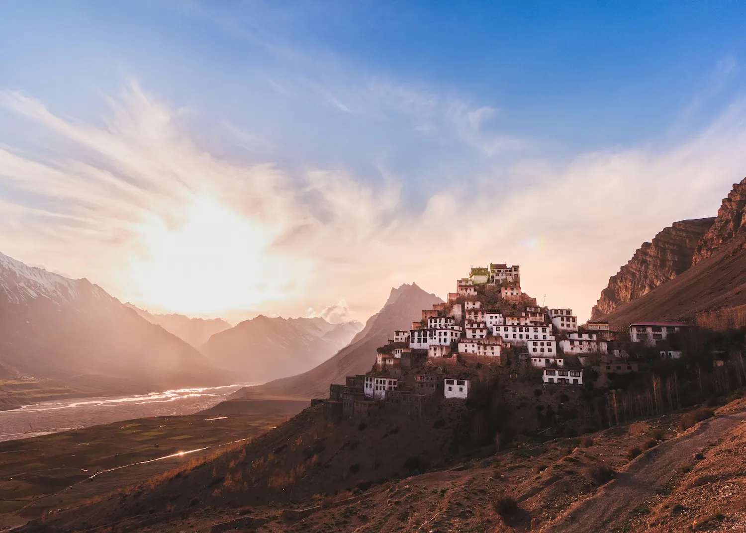
The standard tourist route hits Key Monastery, Dhankar Monastery, Tabo Monastery — tick, tick, tick, done, next. Which misses the point so thoroughly it's almost impressive. The monasteries are extraordinary, but each has a history that takes actual time to absorb. Tabo was founded in 996 CE by Rinchen Zangpo. It's the oldest continuously operating monastery in India. The Archaeological Survey of India doesn't allow photography inside the main assembly hall — which means the only way to experience the thousand-year-old frescoes is to go in and look at them. The Dalai Lama has visited multiple times and has expressed a wish to retire here. That's not a rest stop on a highlights reel.
The villages are where Spiti's actual character lives. Langza, with its giant Buddha and a valley floor scattered with 50-million-year-old marine fossils from the Tethys Sea — you can pick them up off the ground. Hikkim and its post office at 4,400 metres, open since 1983, where postmaster Rinchen Chhering still walks the mail to Kaza on foot. Komic at 4,587 metres, with an 800-year-old monastery that almost nobody visits. Demul, which has a quietness that's hard to explain until you've been there. Sit down in one of these places. Have a meal at a homestay. The people are warm and curious and they are not here to be your backdrop.
| Site | Founded | Altitude | What Makes It Worth Stopping For |
|---|---|---|---|
|
Tabo Monastery |
996 CE |
3,050 m |
Oldest continuously operating monastery in India. 9 temples, 23 chortens, 1,000-year-old frescoes. No photography inside main hall — must be seen in person. Dalai Lama has expressed a wish to retire here. |
|
Key Monastery (Ki Gompa) |
11th century CE |
4,166 m |
Most photographed building in Spiti. 300+ monks at peak. Labyrinthine rooms, thangkas, rooftop views. Go before 7 AM to beat tour groups. |
|
Dhankar Monastery |
7th–10th century |
3,894 m |
Perched on a vertiginous cliff. Original fort-monastery, partially crumbling. 1 km trek above leads to Dhankar Lake — turquoise water, complete silence. |
|
Komic — Tangyud Gompa |
14th century |
4,587 m |
800 years old. One of the highest monasteries in the world. Extensive library of scrolls and thangkas. Rarely crowded. |
|
Langza Buddha & fossil valley |
Medieval |
~4,400 m |
Giant Buddha overlooks a valley floor covered in marine fossils from when the Tethys Sea covered this region — 50 million years ago. You can pick fossils up off the ground. |
|
Gue Mummy Monastery |
~500 years old |
~3,000 m |
Naturally mummified monk — hair and teeth still intact. Most visitors miss it entirely by rushing to Tabo. |
Table 5 — Spiti Monastery & Heritage Site Reference
Leaving No Room for the Weather and the Road
Spiti's weather isn't a background condition — it's a character in the story. Clear sky to full storm in under an hour. Roads wash out. Kunzum Pass closes without warning when snow decides to show up early. The traveller with a rigid seven-day itinerary and a flight home on Day 8 is the traveller you'll find stranded at Kunzum Top in sideways rain, trying to reach an airline on a BSNL connection with one bar.
Build at least two buffer days into any Spiti itinerary. Ideally three. I know that sounds like pessimism, but it isn't — it's what every single experienced Himalayan traveller will tell you, and it's the one piece of advice that first-timers ignore and then very specifically regret. The best Spiti stories I've heard always start with plans falling apart. The people telling those stories are always glad they had nowhere they had to be.
The Plastic Problem
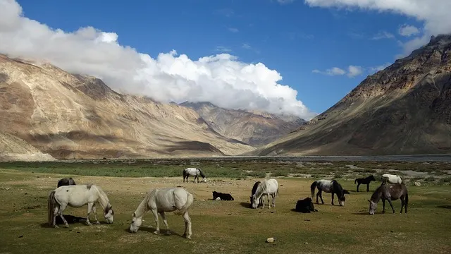
This one is less about your trip going badly and more about what your trip does to a place that has essentially no capacity to absorb it. Spiti's permanent population is around 12,445 people. There is no municipal waste processing facility in the valley. And every tourist season, visitors leave behind plastic — primarily water bottles — that piles up on riverbeds, roadsides and glacial streams with nowhere to go. Spiti Ecosphere, the main environmental organisation working in the valley, estimates that over 300,000 plastic bottles are discarded here in a single season. That's roughly 24 bottles per permanent resident, deposited in a cold desert ecosystem where essentially nothing breaks down.
| Environmental Fact | Figure | Source / Context |
|---|---|---|
|
Plastic bottles discarded in Spiti per tourist season |
300,000+ (conservative) |
Spiti Ecosphere |
|
Permanent population of Spiti Valley |
~12,445 people |
Census of India / Lahaul & Spiti district |
|
Bottles per resident per season (ratio) |
~24 plastic bottles per person |
Derived from Spiti Ecosphere data |
|
Waste generated by tourists vs local residents globally |
Tourists generate 2× as much waste |
UNEP — Global Tourism Plastics Initiative |
|
Annual solid waste generated worldwide by tourists |
35 million tonnes |
UNEP estimate |
|
Municipal waste processing facility in Spiti |
None |
Spiti Ecosphere / District Administration |
|
Spiti Ecosphere water refill stations |
Active network across major settlements |
spitiecosphere.com — mapped on Google Maps |
|
What happens to non-biodegradable waste |
Accumulates on riverbeds, roadsides, glacial streams |
The Shooting Star / Spiti Ecosphere field documentation |
Table 6 — Environmental Impact of Tourism in Spiti Valley
The fix is simple. Carry a reusable bottle and use the Spiti Ecosphere refill station network — it's active across the valley and on Google Maps. Carry your non-biodegradable waste out, all the way to a city with actual waste management. Ask your accommodation whether they have a refill and disposal policy before you book. Spiti Ecosphere's website at spitiecosphere.com is the place to start if you want to understand what responsible travel here actually looks like.
Treating It Like a Destination to Be Conquered
This is the one that's hardest to put into a table. Spiti is not a place you conquer. There's no summit to claim, no box to tick that proves you did it right. The food is simple — dal, rice, thukpa, momos, butter tea that tastes exactly as unfamiliar as you'd expect. Connectivity is intermittent. The roads are genuinely hard. The altitude doesn't care about your timeline.
And yet there's something about this valley that gets into you in a way that's difficult to explain to someone who hasn't been. The light at golden hour hitting the Pin Valley cliffs. The silence at Chandratal before dawn. The Tabo frescoes in lamplight, painted a thousand years ago, still there. The feeling you get at Kibber — 4,270 metres, at the edge of where people have decided to make their lives — that it's more beautiful than you had any right to expect, and that you almost missed it because you were in a hurry.
Go slowly. Go prepared. Carry your waste out. And go already knowing that Spiti will give you exactly as much as you're willing to receive.
Quick Reference: Everything You Need Before You Book
| What You Need to Know | The Answer |
|---|---|
|
Average altitude of Spiti Valley |
3,800 metres (12,467 ft) |
|
Highest point on tourist circuit |
Komic village — 4,587 m (world's highest motorable village) |
|
Kunzum Pass — altitude and open season |
4,590m; typically open June to October/November only |
|
Tabo Monastery — age |
Founded 996 CE — over 1,029 years old; oldest continuously operating in India |
|
World's highest post office |
Hikkim, 4,400m — operational since 1983; postmaster walks to Kaza to deliver mail |
|
AMS risk at Spiti altitude |
28.7% prevalence even among permanent residents between 3,000–4,200m |
|
Best ascent route for acclimatisation |
Shimla → Nako → Tabo → Kaza (3–4 days). Do not rush via Manali. |
|
Inner Line Permit requirement |
Foreign nationals: required for upper villages. Indian nationals: valid photo ID only. |
|
Best mobile network |
BSNL — widest coverage. Jio and Airtel work in Kaza only. |
|
Plastic bottles per tourist season |
300,000+ (Spiti Ecosphere estimate) |
|
Winter temperatures in Tabo |
Down to −45°C overnight |
|
UV radiation at 3,800m vs sea level |
~25% higher — SPF 50+ sunscreen is not optional |
|
Road distance Shimla to Kaza |
~412 km — minimum 2 days |
|
Road distance Manali to Kaza (via Kunzum) |
~195 km — 8–10 hours under good conditions |
Table 7 — Spiti Valley Master Reference
The valley has been here for several million years. It will outlast every itinerary. The only question is whether you went slowly enough to actually see it.
Best Selling Tour Packages
Explore other exciting options for your next adventure!