

Karan
Writer
Updated On - Oct 05, 2026
20 min
Published On - Oct 05, 2026
Umling La — The World's Highest Motorable Road
Discover Umling La, the world's highest motorable road at 19,024 ft in Ladakh. Learn how to reach, permits required, best time to visit, road conditions, altitude challenges, and travel tips for an unforgettable Himalayan adventure.
The altimeter reads 5,798 metres. Your lungs are working harder than they have ever worked in your life. The prayer flags above the summit signboard are cracking in a wind so cold and so thin it feels like breathing through a straw at the top of the world. And in a very real sense, you are. Welcome to Umling La.
The road that touches the sky
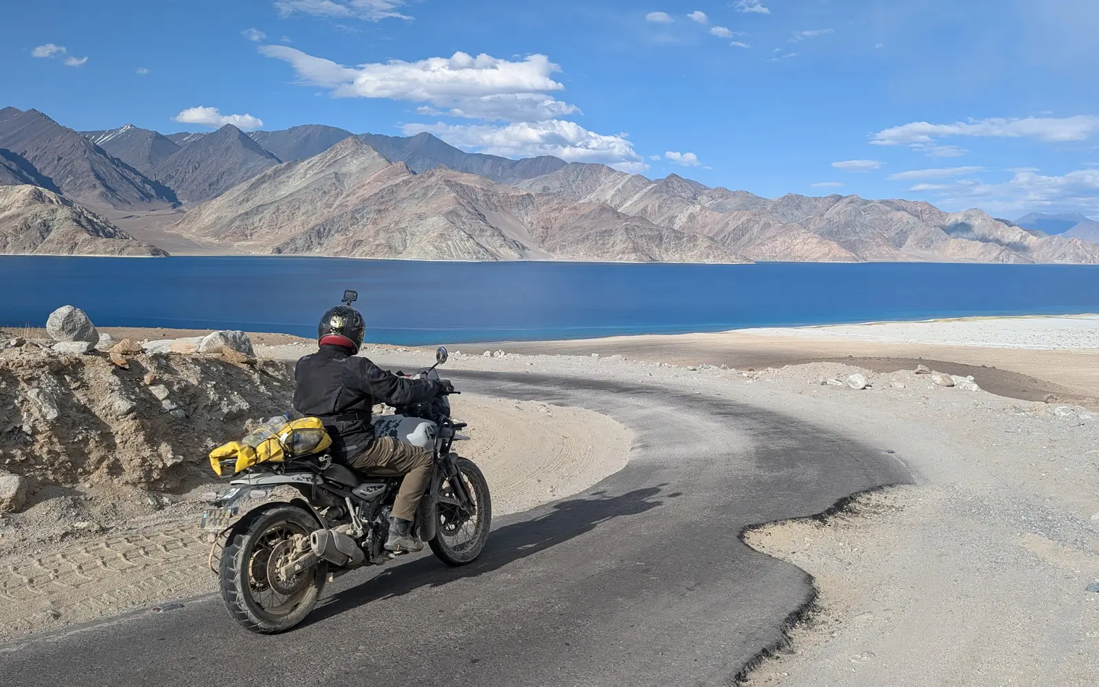
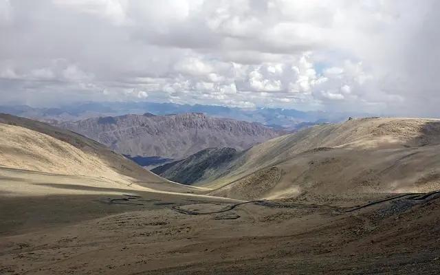
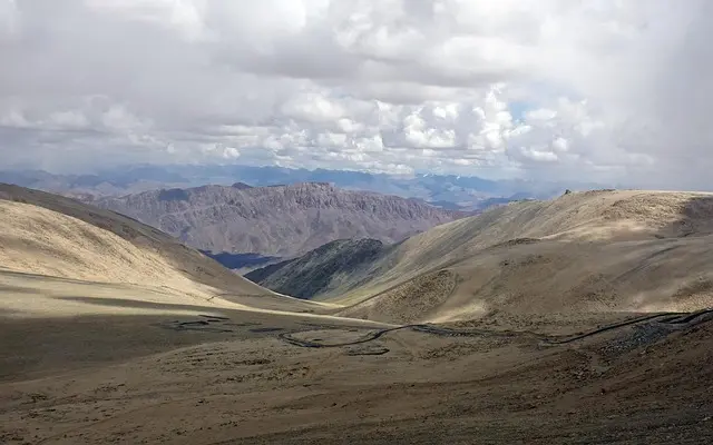
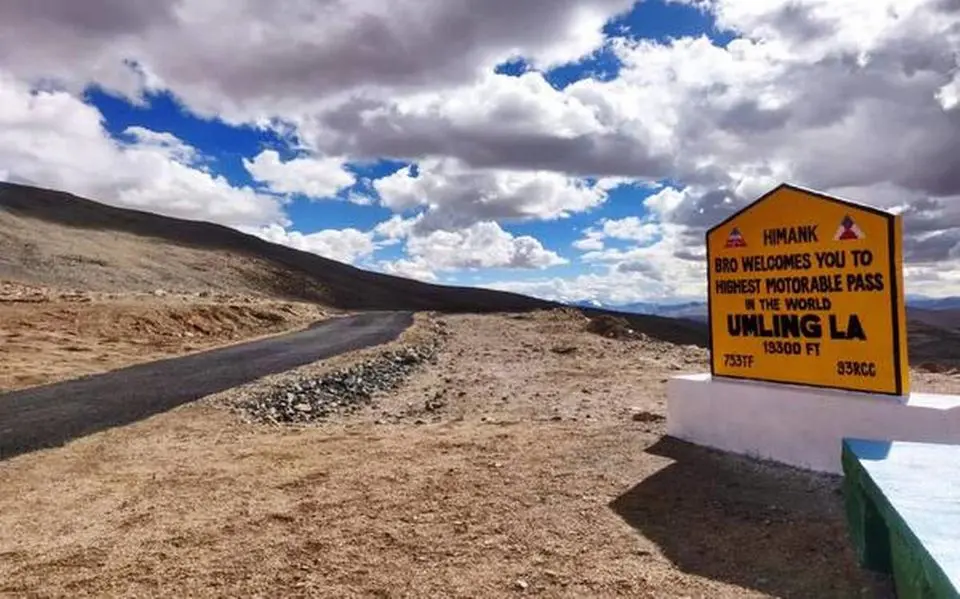
The air is different before you even reach the top. Somewhere around 5,000 metres — still three to four kilometres from the Umling La summit — you become aware that your breathing has changed. Not laboured, not painful, just different. More deliberate. The body quietly recalibrating, drawing harder on air that contains roughly half the oxygen of the air you breathe at sea level. I follow the road upward through a landscape so utterly stripped of softness — no trees, no grass, no water, no colour beyond the ochre and copper and grey of ancient rock — that it feels like driving across the surface of a planet that has decided it has no further need for the biological world. For those who choose a premium Leh Ladakh biking safari as the vehicle for this journey, this is the moment the word 'premium' finally earns its keep. The road ends at a BRO signboard, faded yellow against the brown ridgeline, the prayer flags around it shaking in the relentless high-altitude wind. Umling La. 5,798 metres. 19,024 feet. The world stops here.
Except that it no longer quite stops here — and that is a story worth telling. For several glorious years, from 2017 to 2025, Umling La held the Guinness World Record as the highest motorable road on earth, dethroning the road to the Uturuncu volcano in Bolivia and the Mana Pass in Uttarakhand in one magnificent stroke of Indian engineering ambition. Then in October 2025, Project Himank of the Border Roads Organisation did what only Project Himank could do — it surpassed its own record. The new Mig La Pass, part of the Likaru-Mig La-Fukche strategic road alignment in eastern Ladakh, rises to 19,400 feet (5,913 metres), and the BRO team hoisted the national flag there on 4 October 2025 under Brigadier Vishal Srivastava. Umling La is now technically the world's second-highest motorable road. But here is the honest truth: Mig La is currently a rough military dirt track with no civilian access. Umling La, with its BRO-maintained tarmac and documented route from Hanle, remains the highest motorable road you can actually ride. The title may have shifted. The experience has not.
Umling La is located in eastern Ladakh near the remote border village of Demchok, along the ridgeline between Koyul Lungpa and the Indus River, close enough to the Line of Actual Control with China that the entire area is classified as a sensitive border zone. The 86-kilometre road through the pass connects the villages of Chisumle and Demchok — two tiny settlements near the India-China border whose strategic significance far outweighs their modest size. Standing at Umling La and looking toward the horizon, you are looking at one of the most contested frontiers in Asia. This is not merely an adventure road. It is geography with consequences.
| Detail | Information |
|---|---|
|
Altitude |
5,798 metres (19,024 feet) above sea level |
|
Current World Record Status |
World's 2nd highest motorable road (2026). Mig La at 19,400 ft now holds #1 but is not open to civilians. |
|
Guinness World Record |
Held by Umling La 2021–2025. Surpassed by BRO's Mig La in October 2025. |
|
Road Name |
Chisumle–Umling La–Demchok Road (CUD Road) |
|
Road Length |
86 km connecting Chisumle and Demchok villages |
|
Constructed By |
Border Roads Organisation (BRO), Project Himank |
|
Opened to Civilians |
2017 |
|
Location |
Eastern Ladakh, near Demchok. Close to Line of Actual Control with China. |
|
Nearest Base |
Hanle village — ~75 km from summit (~2–3 hours) |
|
Temperature at Summit |
-10°C to -20°C in summer. Down to -40°C in winter. |
|
Oxygen Level at Summit |
Approximately 50% lower than at sea level |
|
Higher Than |
Everest South Base Camp (17,598 ft), Khardung La (17,582 ft), commercial helicopter cruising altitude |
|
Permit Required |
EDF + Hanle/Umling La sector permit via lahdclehpermit.in (Indian nationals) |
|
Foreign Nationals |
Generally NOT permitted as of 2026. Verify with Leh DM office before planning. |
Umling La — Essential Facts at a Glance
UMLING LA IS HIGHER THAN EVEREST BASE CAMP. HIGHER THAN THE CRUISING ALTITUDE OF MANY COMMERCIAL HELICOPTERS. AT THE SUMMIT, OXYGEN IS 50% OF WHAT IT IS AT SEA LEVEL, THE WIND TEARS THROUGH LAYERS YOU THOUGHT WERE ADEQUATE, AND THE SILENCE BETWEEN GUSTS IS THE DEEPEST SILENCE YOU WILL EVER HEAR. THIS IS NOT A TOURIST DRIVE. IT IS A RECKONING.
The men who built the road the sky forgot
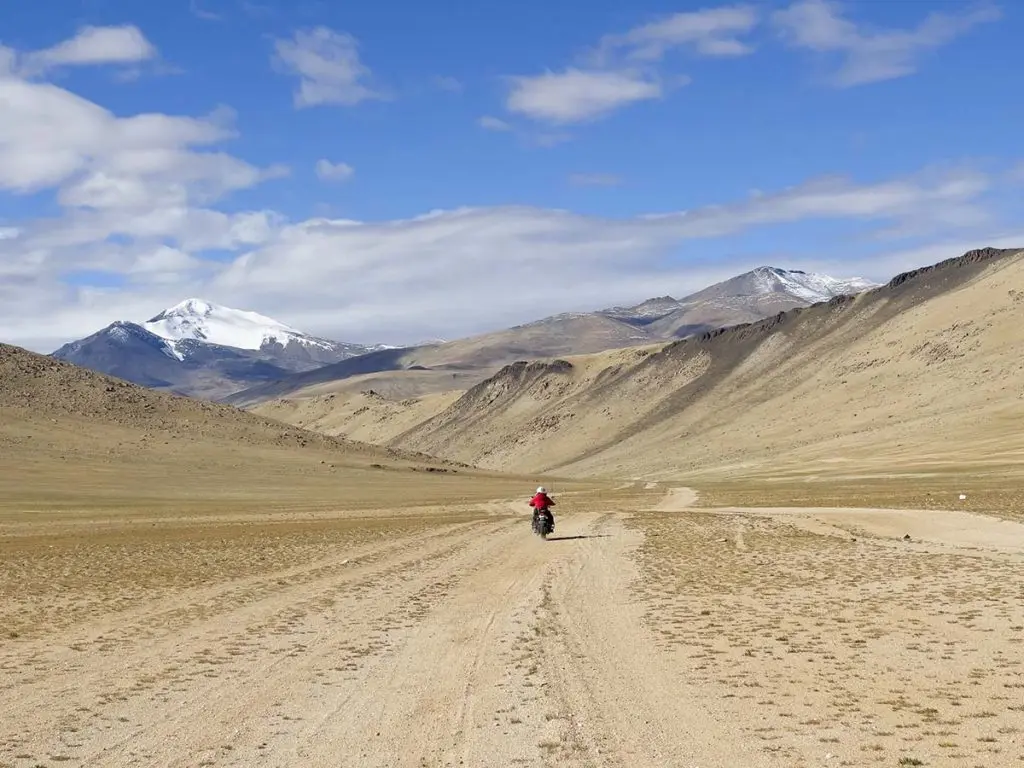
No account of Umling La is complete without acknowledging what it took to build the road. Project Himank — the BRO task force established in August 1985 specifically for strategic road development in Ladakh and high-altitude border regions — has constructed 11 of the world's 14 highest motorable passes. This is not a statistic. It is the biography of men who work at temperatures of minus 40 degrees Celsius, in air containing half the oxygen of the plains, on rock faces that shift under snowfall and freeze in the night, building roads that connect India's most remote border settlements to the country they belong to.
The Chisumle–Demchok road took six years to build. Workers required special high-altitude acclimatisation training before they could function at the elevation where the road needed to be cut. The BRO's construction teams on Project Himank did not just build Umling La — they built the approach roads, the foundations at Chisumle and Demchok, and the maintenance infrastructure that keeps the route navigable in summer. When you ride or drive to Umling La and reach the summit sign, the correct first response is not a selfie. It is a moment of genuine respect for the people who made that road possible at all.
In October 2025 the BRO surpassed its own record at Mig La, part of the Likaru-Mig La-Fukche alignment forming a crucial third strategic axis connecting Hanle to the border at Fukche. Mig La is, for now, a military strategic road — a rough dirt track accessible only under military operation. Project Himank is systematically connecting India's easternmost Ladakhi villages to each other and to the country, one extraordinary high-altitude road at a time. Umling La was not the end of the story. It was the chapter that changed what the story was about.
Hanle — the launchpad you will not want to leave
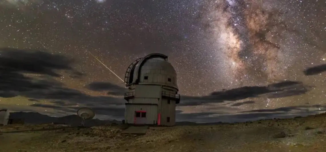
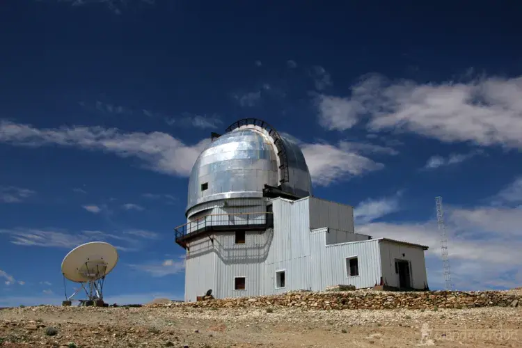
Every serious attempt on Umling La begins the night before in Hanle, a village at 4,630 metres in the Changthang plateau that deserves considerably more attention than it usually gets as a stopover. Hanle is home to the Indian Astronomical Observatory — one of the world's highest astronomical research stations, operated by the Indian Institute of Astrophysics, equipped with a 2-metre optical telescope. The location was chosen for its cloudless skies, negligible light pollution, low humidity and minimal rainfall. For anyone on an elite Leh Ladakh photography tour, this combination of factors makes Hanle not merely a stop on the route to Umling La but a destination of serious photographic value in its own right.
In 2022 Hanle was formally designated India's first Dark Sky Reserve — the Hanle Dark Sky Reserve (HDSR) — a protected area whose light pollution rules are enforced with genuine seriousness. Driving with high-beam headlights after dark is strictly prohibited. Guest house and homestay owners enforce this without apology. What you get in return is, on a clear night, the Milky Way stretching across the sky in a clarity that makes even experienced travellers stop mid-sentence and look upward. A royal Ladakh moonlit valley glamp under these skies — lying on your back on the Changthang plateau with the galaxy performing overhead and Umling La waiting for you in the morning — is one of those travel experiences that recalibrates your sense of scale permanently. I have seen the Milky Way from many places. Hanle is the only place where I have seen it look like a painting that is slightly too good to be real.
Stay at least one night in Hanle before attempting Umling La — two nights is better, particularly if you have not previously spent time above 4,500 metres. The acclimatisation difference between arriving at Hanle and immediately driving to the summit versus arriving, sleeping, and driving the next morning is significant and entirely worth the extra day. Your engine will thank you too: at this altitude, even fuel-injected motorcycles lose 30 to 40 percent of their torque. A body that has had 24 hours to adjust to 4,630 metres will function considerably better at 5,798 than one that has not.
Getting there — routes from Hanle to the summit
There are three primary routes from Hanle to Umling La, each with a distinct character. The standard route via Photi La is the most documented and most reliable for both a high-end Ladakh off-road SUV expedition and two-wheeled riders. The Nurbula Top circuit is more adventurous and works best in dry conditions. The Demchok approach from the south is the most remote and is specialist territory only. All three require that you have already reached Hanle — itself approximately 260 kilometres and six to seven hours from Leh via the Loma bend and the Indus Valley crossing.
One thing no map can fully prepare you for: the road from Hanle to the summit is a landscape so empty and so vast that it genuinely resets something in the brain. No mobile signal. No other vehicles for long stretches. No trees, no birds, no running water. Just the road, the rock, the sky, and the sound of your engine working harder than it ever has. Fuel-injected bikes — the Royal Enfield Himalayan 450, KTM Adventure series, newer Classic 350s — will have their ECU automatically adjusting the fuel-to-air ratio as the air thins. Carburettor bikes will run progressively rich, emit black smoke, and potentially stall. Know your machine before you commit to this road.
| Route | Distance from Hanle | Duration | Road Surface | Best For |
|---|---|---|---|---|
|
Route 1: Hanle → Photi La (5,524m) → Chisumle → Umling La |
~75 km one way |
2–3 hrs one way |
Mix of tarmac and gravel. BRO-maintained. Most reliable all-weather route. |
First-timers; 4WD SUV expedition; all bikes |
|
Route 2: Hanle → Ukdungle → Nurbula Top → Umling La circuit |
~85 km one way |
3–4 hrs one way |
Dirt track from Hanle to Nurbula Top. Challenging in wet. Can be done as circuit with Route 1. |
Adventure riders; experienced off-road drivers; dry season only |
|
Route 3: Demchok approach from south via Fukche |
Longer; specialist route |
4–5+ hrs |
Rough in sections; remote; passes through sensitive border areas near LAC. |
Specialist expeditions only; additional permits may be required |
Routes to Umling La from Hanle — 2026
THE BRO BUILT UMLING LA IN SIX YEARS, AT MINUS 40 DEGREES, WITH HALF THE OXYGEN OF THE PLAINS, ON ROCK THAT SHIFTS AND FREEZES AND SHIFTS AGAIN. WHEN YOU STAND AT THE SUMMIT, THE CORRECT FIRST RESPONSE IS NOT A SELFIE. IT IS A MOMENT OF GENUINE, QUIET RESPECT FOR THE PEOPLE WHO MADE THAT SUMMIT SIGN POSSIBLE AT ALL.
Things to do at Umling La and the eastern Ladakh circuit...
Spend the night in Hanle and stargaze properly. Do not treat Hanle as merely a fuel and sleep stop before the summit push. The Hanle Dark Sky Reserve designation is a scientifically maintained protected area — the finest premium Leh Ladakh stargazing camp experience available anywhere in India, anchored by certified Astro-stays whose light pollution compliance rules make the night sky here genuinely extraordinary. After dinner, walk away from the guesthouse lights, lie on your back on the flat plateau ground, and look up. The Milky Way at Hanle on a clear October night is the kind of thing that recalibrates your sense of scale permanently. Bring a DSLR with a tripod: 2-second exposure, wide aperture, ISO 1600 produces photographs you will spend the rest of your life trying to recreate.
Visit Hanle Monastery before the Umling La drive. The 17th-century Hanle Gompa, perched on a hill above the village, is one of the oldest and most architecturally significant monasteries in the entire Changthang. Its main assembly hall contains an extraordinary two-storey Maitreya statue and rare thangka murals that have survived centuries of Changthang winters. The monastery receives a fraction of the visitors that the Indus Valley monasteries attract, which means you will very likely have it almost to yourself. Walk up slowly, sit in the courtyard, watch the prayer flags move in the morning wind. The monastery has been there since 1633. The road to Umling La will still be there when you come back down.
Drive to the summit and stay no more than 30 to 60 minutes. At 5,798 metres with 50 percent of sea-level oxygen, every minute you spend stationary at the summit is a minute your body is being challenged without the compensation of altitude gain. Most experienced high-altitude travellers recommend a maximum of 30 to 60 minutes at the summit before beginning the descent. Take your photographs, read the sign, feel the wind, look at the horizon — then go back down. The altitude sickness that catches people at Umling La does not announce itself loudly. It arrives quietly as a headache, a slight dizziness, a sense of unreality. Descend before it deepens.
Visit the Indian Astronomical Observatory at Hanle. The observatory, operated by the Indian Institute of Astrophysics (IIA), is open to visitors on specific days under a regulated visiting protocol — check current access rules with the IIA or your registered operator before departure. The facility houses a 2.01-metre optical-infrared telescope, a High Energy Gamma Ray telescope, and several specialised instruments. Even a guided external visit with an explanation of why Hanle's combination of cloudless skies, low humidity and negligible light pollution makes it one of the world's most valuable astronomical sites adds a dimension to the journey that makes the entire eastern Ladakh circuit feel like considerably more than an altitude achievement.
Do the full Hanle–Umling La–Tso Moriri–Tso Kar circuit if your itinerary allows. For those with five to seven days in eastern Ladakh, the circuit combining Hanle, Umling La, a luxury Tso Moriri remote lake camp for the second night, and a VIP Tso Kar high-altitude lake tour on the return is one of the most rewarding Ladakh itineraries available — away from the more crowded Pangong and Nubra routes, through a landscape of raw, almost lunar beauty. The route from Hanle to Tso Moriri via Nyoma and Mahe is approximately 130 kilometres through the Changthang plateau. Requires proper permit planning for all three zones on one application and a minimum of seven to eight days of acclimatisation from Leh.
| Month | Summit Conditions | Road Status | Temp at Summit | Verdict |
|---|---|---|---|---|
|
May |
Likely still snowbound. Route uncertain. |
Route 1 may open late May. Verify with BRO before planning. |
-15°C to -25°C |
Too early for most. Check road status first. |
|
June |
Generally open from mid-June. |
Route 1 open. Route 2 (Nurbula) may still be soft from snowmelt. |
-12°C to -20°C |
Good. Fewer visitors. Start early each day. |
|
July |
Fully open. Peak season begins. |
Both main routes open. Avoid riding in approaching rain or clouds. |
-10°C to -18°C |
Excellent. Roads in best condition. Warmest month. |
|
August |
Fully open. Possible afternoon clouds. |
Watch for rain in late afternoon. Start summit attempt by 8am latest. |
-10°C to -18°C |
Very good. Same cautions as July re: afternoon weather. |
|
September |
Open. Post-monsoon clarity. |
Roads stable. Best photography month. Hanle stargazing at its peak. |
-12°C to -20°C |
Outstanding — finest month for the full circuit. |
|
October |
Early closure risk from snowfall. Verify. |
May close mid-October depending on snowfall. Check BRO updates. |
-18°C to -28°C |
Experienced and well-equipped travellers only. |
|
Nov–April |
Closed under deep snow. |
Road completely blocked. |
-30°C to -40°C |
Not accessible. |
When to Go — Season Guide for Umling La
Things not to do at Umling La...
Do not attempt Umling La without spending at least three to four nights in Ladakh first. This is not optional caution — it is the physiological reality of what 5,798 metres does to a body that is not prepared for it. Two nights in Leh, then one to two nights in Hanle at 4,630 metres, and then the summit attempt the following morning. At the summit, oxygen is 50 percent of sea level. Your body needs every day of acclimatisation it has been given to function safely at that altitude. Fit people get AMS at Umling La just as regularly as unfit ones. The altitude does not care about your training schedule.
Do not linger at the summit for more than 30 to 60 minutes. The AMS that catches people at Umling La arrives without drama and escalates quickly. Headache, unusual dizziness, a sense of the world being slightly off-register — these are the early signals. If you feel any symptom at all: finish what you are doing, get back in the vehicle or back on the bike, and start descending immediately. Even 200 to 300 metres of descent can produce rapid improvement. Portable oxygen cans (OXY99 and similar) are available in Leh and are strongly recommended. A premium Ladakh helicopter tour can serve as an emergency evacuation option from the eastern Changthang, but helicopter evacuation from this altitude starts at ₹3 to ₹6 lakhs minimum — another compelling reason why high-altitude travel insurance is non-negotiable before this trip.
Do not ride a carburettor motorcycle without understanding what altitude does to it. At 5,798 metres, internal combustion engines breathe air just like we do — and at 50 percent oxygen, they struggle. A carburettor motorcycle will run progressively rich as the altitude increases: too much fuel, not enough air. The engine will lose 30 to 40 percent of its torque, refuse to idle, emit black smoke, and may stall immediately when you release the throttle. Modern fuel-injected bikes — the Royal Enfield Himalayan 450, KTM Adventure series, Triumph Scrambler — have ECUs that automatically adjust fuel delivery to compensate. If you are riding a carburettor bike, read your specific model's altitude performance before committing to this road.
Do not start the summit attempt after 9am. Weather at extreme altitude changes with very little warning. Afternoon clouds, which can bring snow even in July, begin building at Umling La from around midday. The widely agreed rule: leave Hanle no later than 6am, reach the summit by 9am, spend your 30 to 60 minutes at the top, and be on the descent by 10am. This leaves you back at Hanle by early afternoon with full visibility throughout. The people who end up in trouble at Umling La are almost always the ones who started late.
Do not travel without the correct permits — and foreign nationals must verify access before planning. Indian nationals require an EDF permit with the Hanle and Umling La sector specifically selected, applied online at lahdclehpermit.in. An additional SDM Nyoma endorsement may be required depending on current military sensitivity. The army reserves the right to turn civilians back at the Loma bend or Photi La on any day without prior notice — this happens when the border situation requires it and there is no appeal. Foreign nationals including OCI cardholders are generally not permitted to access Hanle and Umling La as of 2026. Always verify directly with the Leh District Magistrate's office before planning your itinerary around this route.
Do not carry single-use plastic. Full stop. The eastern Changthang is among the most ecologically pristine and least visited sections of Ladakh. There is no waste management anywhere on this route. Everything you carry in, you carry out. A LifeStraw bottle removes the plastic bottle problem. A small dry bag for all your waste handles the rest. The landscape between Hanle and Umling La has the quality of a place that has not yet been fully discovered by mass tourism. That quality is worth protecting.
| Visitor Type | Permit Required | How to Get It | Cost | Critical Notes |
|---|---|---|---|---|
|
Indian Nationals |
Environment Development Fee (EDF) — Hanle/Umling La sector |
Online at lahdclehpermit.in. Select Hanle and Umling La sectors specifically. |
₹400 base + ₹20/day |
Additional SDM Nyoma endorsement may be required. Army can turn back civilians at any point near LAC without notice. No refund or appeal. |
|
Foreign Nationals (incl. OCI) |
Generally NOT permitted as of 2026 |
Verify directly with Leh District Magistrate office before planning |
— |
Access has fluctuated. Do NOT plan an itinerary around Umling La as a foreign national without current official confirmation. |
|
Vehicles |
Vehicle registration + insurance checked at checkpoints |
Standard vehicle documentation |
Included in vehicle cost |
High-clearance 4WD SUV or robust adventure motorcycle strongly recommended. |
Permit Requirements — Hanle and Umling La 2026
Where to stay — Hanle village
There is no accommodation at Umling La itself. None whatsoever. The nearest settlement is Hanle, approximately 75 kilometres from the summit, and all overnight stays are based there. This is not a compromise — Hanle is, as already established, a genuinely extraordinary place to spend a night. For those who want the most immersive experience, the village's certified Astro-stays offer a boutique Leh Ladakh glamping experience unlike anything available elsewhere in India: small, intimate, light-pollution-controlled properties whose entire design philosophy centres on the night sky above the Changthang plateau. The telescope, the Milky Way, the silence, the 5,798 metres waiting for you in the morning — it is a complete experience, not just a place to sleep.
Electricity in Hanle runs on a generator schedule — approximately four to five hours in the evening. Mobile signal is limited to BSNL and occasional Jio postpaid coverage; prepaid SIMs stop working here as they do throughout remote Ladakh. There are no ATMs. Bring all cash from Leh. The homestay owners will feed you, house you, and point you toward the observatory with genuine warmth. The Ladakhi word julay — hello and thank you in one — is the best thing you can learn before arriving.
| Property | Type | Price / Night | Notes |
|---|---|---|---|
|
Hanle House |
Homestay near Hanle Monastery |
₹1,500–₹3,000 |
Comfortable rooms, local food cooked fresh. Good views of monastery hill. Warmly run by local family. |
|
Padma Homestay |
Family homestay |
₹1,200–₹2,000 |
Budget-friendly, authentic Ladakhi experience, home-cooked meals. Simple and honest. |
|
Sonam Guest House |
Basic guesthouse |
₹1,000–₹2,000 |
Located close to Hanle Observatory. Simple but comfortable. Helpful hosts. Good base for early-morning summit departure. |
|
Dark Sky Reserve certified Astro-stays |
Boutique glamping — certified properties |
₹2,000–₹5,000 |
The finest boutique Leh Ladakh glamping experience in eastern Ladakh. Certified by the Dark Sky Reserve administration for minimal light pollution compliance. Foreign nationals (when permitted) must stay at these registered Astro-stays only. |
Where to Stay — Hanle Village (Base for Umling La)
AT HANLE THE MILKY WAY DOESN'T JUST APPEAR — IT STRETCHES ENDLESSLY ACROSS THE SKY WITH A CLARITY MOST TRAVELLERS NEVER WITNESS IN THEIR LIFETIME. YOU LIE ON YOUR BACK ON THE CHANGTHANG PLATEAU, WITH UMLING LA WAITING FOR YOU IN THE MORNING AND THE ENTIRE GALAXY PERFORMING OVERHEAD, AND YOU THINK: THIS IS EXACTLY WHAT TRAVEL IS SUPPOSED TO FEEL LIKE.
Travelling responsibly on the road to the sky...
The eastern Changthang is one of the least visited and most ecologically sensitive parts of Ladakh. The road to Umling La passes through a landscape of extraordinary fragility — high-altitude desert ecosystems, rare bird habitats, and the grazing grounds of Changpa nomadic communities whose pastoral routes predate the road by centuries. Every traveller on this road is a guest in a landscape that managed perfectly well without tourists and will continue to do so.
Respect the military presence without resentment. The soldiers posted along the LAC in this sector live and work in conditions that make a cold night at Hanle seem rather comfortable. They are not obstacles — they are the reason this road exists and the reason you can drive it. Cross every checkpoint with documents ready, cooperate fully, and carry the patience you would want from someone visiting your home. If the army turns you back on a given day, accept it. The mountain will still be there another day.
Carry nothing in single-use plastic and carry all waste out. There is no infrastructure to handle it here. Bring a LifeStraw bottle, a dry bag for waste, and the understanding that leaving the road to Umling La as clean as you found it is the most meaningful thing you can do to honour the people who built it.
And spend a night at Hanle, not just a few hours. The village deserves it. The observatory deserves it. The sky over the Changthang at 2am, when the Milky Way has rotated to show you its core and the cold is sharp enough to make every star seem closer than it should be — that deserves far more than a quick look through a windshield on the way to and from a summit photograph.
Before you go...
Apply for your EDF permit at lahdclehpermit.in with the Hanle and Umling La sectors specifically selected. If you are travelling to Tso Moriri or Pangong on the same circuit, add those zones to the same application. Carry a printed receipt and your original government ID. Check the current military access status for the Umling La road in the week before your planned visit — army restrictions near the LAC can be imposed at short notice.
Carry portable oxygen cans from Leh — OXY99 and similar brands are available in the main Leh market. Carry Diamox if your doctor has prescribed it. Know the symptoms of AMS, HAPE and HACE before you start. The nearest hospital from Umling La is in Leh — a minimum of eight to nine hours away by road. Fill your tank completely in Leh and carry a Jerry can. There are no fuel stations in Hanle or on the route to Umling La. Start each day's riding no later than 6am for any pass attempt. Download offline maps in Leh before you lose signal.
At BizareXpedition, we craft fully customised luxury Leh Ladakh tour packages built around the Umling La summit experience — combining the right acclimatisation schedule, Hanle Astro-stay stargazing nights, the Indian Astronomical Observatory visit, and an ultra-luxury Ladakh adventure package that continues through Tso Moriri and the eastern Changthang circuit. Every detail planned, every permit sorted, every sunrise earned. Visit bizarexpedition.com to start building your eastern Ladakh journey.
| Category | What to Carry | Why It Matters at Umling La Specifically |
|---|---|---|
|
Fuel |
Full tank in Leh + Jerry can |
No fuel stations in Hanle or anywhere on route. Last pump is Leh. |
|
Oxygen |
Portable oxygen cans (OXY99 or similar) + medical cylinder if leading a group |
50% sea-level oxygen at summit. AMS onset without warning. Nearest hospital 8–9 hours away. |
|
Health |
Diamox (consult doctor) + first aid kit + personal medications |
Extreme altitude. AMS, HAPE and HACE risk significantly higher than anywhere in standard Ladakh. |
|
Warmth |
Down jacket, thermal base layers, balaclava, windproof gloves, goggles for riders |
-10°C to -20°C at summit even in summer. Wind amplifies cold significantly. |
|
Documents |
EDF permit (print + offline) + original govt ID + vehicle papers |
Multiple checkpoints. Army may require additional documentation near LAC. No permit = turned back. |
|
Cash |
All cash for entire circuit from Leh |
No ATMs in Hanle or eastern Changthang. No digital payments anywhere. |
|
Connectivity |
BSNL/Jio postpaid SIM + offline maps downloaded in Leh |
No signal from Hanle onward. Prepaid SIMs stop working outside Leh city. |
|
Bike/Vehicle |
Fuel-injected motorcycle or high-clearance 4WD SUV strongly recommended |
Carburettor bikes run rich and may stall at altitude. Low-clearance cars struggle on Nurbula route. |
|
Timing |
Leave Hanle by 6am. Reach summit by 9am. Descend by 10am. |
Afternoon weather at 5,798m can deteriorate rapidly. No shelter anywhere on the road. |
|
Insurance |
High-altitude travel insurance covering helicopter evacuation |
Evacuation from this altitude starts at ₹3–₹6 lakhs. Non-negotiable. |
Practical Checklist — What to Carry for Umling La
| Category | Budget | Mid-Range | Notes |
|---|---|---|---|
|
Hanle Homestay (per night) |
₹1,000–₹2,000 (basic homestay) |
₹2,000–₹5,000 (Astro-stay certified) |
Foreign nationals: Astro-stay only. Book in advance — very limited beds. |
|
Meals in Hanle (per day) |
₹500–₹800 (homestay meals) |
₹800–₹1,200 (guesthouse dining) |
Dal-bhaat, thukpa, local bread. Limited menu. Tell hosts dietary requirements on arrival. |
|
Taxi Leh–Hanle–Leh return |
₹12,000–₹16,000 (shared/basic) |
₹18,000–₹25,000 (private 4WD) |
Book a driver who has driven to Umling La before. Ask directly. |
|
Fuel (Leh to Umling La circuit) |
₹2,000–₹3,500 depending on vehicle |
— |
Fill in Leh. Carry Jerry can. Calculate your vehicle's range carefully. |
|
Permits (EDF) |
₹400 + ₹20/day per person |
Same |
Apply online before departure. Include all zones on one application. |
|
Emergency insurance |
₹2,000–₹5,000 (10-day policy with altitude cover) |
₹5,000–₹15,000 (full expedition cover) |
Non-negotiable. Helicopter evacuation from this altitude costs ₹3–₹6 lakhs minimum. |
Budget Guide — Umling La Circuit from Leh
The altimeter reads 5,798 metres. The prayer flags crack in the wind. The air is thin and cold and extraordinary. You are standing on a road that should not exist, built by men who decided that the sky was not a limit but a destination. Take a photograph. Take a breath. Take your time going back down.
Best Selling Tour Packages
Explore other exciting options for your next adventure!